Fort-Mahon-Plage
Fort-Mahon-Plage | |
|---|---|
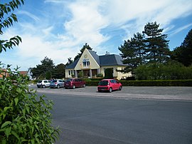 The town hall in Fort-Mahon | |
 Coat of arms | |
show Location of Fort-Mahon-Plage | |
 Fort-Mahon-Plage | |
| Coordinates: 50°20′31″N 1°34′11″E / 50.3419°N 1.5697°ECoordinates: 50°20′31″N 1°34′11″E / 50.3419°N 1.5697°E | |
| Country | France |
| Region | Hauts-de-France |
| Department | Somme |
| Arrondissement | Abbeville |
| Canton | Rue |
| Intercommunality | CC Ponthieu-Marquenterre |
| Government | |
| • Mayor (2020–2026) | Alain Baillet[1] |
| Area 1 | 13.04 km2 (5.03 sq mi) |
| Population (Jan. 2018)[2] | 1,300 |
| • Density | 100/km2 (260/sq mi) |
| Time zone | UTC+01:00 (CET) |
| • Summer (DST) | UTC+02:00 (CEST) |
| INSEE/Postal code | 80333 /80120 |
| Elevation | 1–30 m (3.3–98.4 ft) (avg. 4 m or 13 ft) |
| 1 French Land Register data, which excludes lakes, ponds, glaciers > 1 km2 (0.386 sq mi or 247 acres) and river estuaries. | |


Fort-Mahon-Plage (French pronunciation: [fɔʁ ma.ɔ̃ plaʒ]) is a commune in the Somme department in Hauts-de-France in northern France.
Geography[]
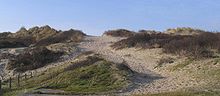
The commune is situated on the coast of the English Channel and endowed with a sandy beach and massive sand dunes, Fort-Mahon-Plage attracts many tourists, especially during the summer and at the weekends. Thanks to investment and the fact the town meets many environmental criteria, the town is officially classified (since 2006), as a “station balnéaire”.
Population[]
| Year | 1962 | 1968 | 1975 | 1982 | 1990 | 1999 | 2006 | 2009 |
|---|---|---|---|---|---|---|---|---|
| Population | 942 | 976 | 978 | 962 | 1042 | 1140 | 1296 | 1311 |
| From the year 1962 on: No double counting—residents of multiple communes (e.g. students and military personnel) are counted only once. | ||||||||
History[]
Fort-Mahon-Plage is not a very old town. It seems certain that it did not exist before the 18th century, except, of course, the superb sand dunes and the sea. Then considered rather cold and wild, this part of the coast would have welcomed only fishermen and shellfish gatherers. The first town was raised there only a little more than two centuries ago, with a few small shepherds’ huts in 1790. Fort-Mahon-Plage was not considered a commune at all until 1923, when it was officially identified as a separate village from its neighbour . Urbanization was steady, notably in the 1950s, with the immense beach of fine sand, in contrast to many of the pebble beaches of Normandy, doing a lot to attract tourists, as well as a soft and pleasant sea during the summer. The huge beach later became famous for its water activities, most notably landyacht racing, wind-surfing and kiting. The town also invested heavily in its infrastructure, most notably the very long principal promenade, the "Avenue de la plage" (Beach Avenue), of a quality design and layout that reinforces the attractiveness of the town.
Twin towns[]
 Bewdley (United Kingdom)
 Wellin (Belgium)
See also[]
References[]
- ^ "Répertoire national des élus: les maires". data.gouv.fr, Plateforme ouverte des données publiques françaises (in French). 2 December 2020.
- ^ "Populations légales 2018". INSEE. 28 December 2020.
External links[]
| Wikimedia Commons has media related to Fort-Mahon-Plage. |
- Official website of Fort-Mahon-Plage (in French)
- Belle Dune Golf Course (in French)
| show Authority control |
|---|
- Communes of Somme (department)
- Seaside resorts in France