Frise, Somme
Frise | |
|---|---|
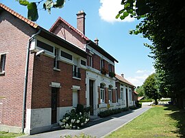 The town hall in Frise | |
show Location of Frise | |
 Frise | |
| Coordinates: 49°56′32″N 2°49′09″E / 49.9422°N 2.8192°ECoordinates: 49°56′32″N 2°49′09″E / 49.9422°N 2.8192°E | |
| Country | France |
| Region | Hauts-de-France |
| Department | Somme |
| Arrondissement | Péronne |
| Canton | Albert |
| Intercommunality | CC Pays du Coquelicot |
| Government | |
| • Mayor (2020–2026) | Michel Randjia[1] |
| Area 1 | 6.15 km2 (2.37 sq mi) |
| Population (Jan. 2018)[2] | 181 |
| • Density | 29/km2 (76/sq mi) |
| Time zone | UTC+01:00 (CET) |
| • Summer (DST) | UTC+02:00 (CEST) |
| INSEE/Postal code | 80367 /80340 |
| Elevation | 41–99 m (135–325 ft) (avg. 50 m or 160 ft) |
| 1 French Land Register data, which excludes lakes, ponds, glaciers > 1 km2 (0.386 sq mi or 247 acres) and river estuaries. | |


Frise is a commune in the Somme department in Hauts-de-France in northern France.

Church of Frise in 1916, after the Battle of the Somme.
Geography[]
Frise is situated by the banks of the river Somme, on the D471 road, some 42 kilometres (26 mi) east of Amiens.
Population[]
| Year | 1962 | 1968 | 1975 | 1982 | 1990 | 1999 | 2006 |
|---|---|---|---|---|---|---|---|
| Population | 137 | 145 | 112 | 131 | 129 | 158 | 181 |
| From the year 1962 on: No double counting—residents of multiple communes (e.g. students and military personnel) are counted only once. | |||||||
History[]
In the Middle Ages the village exploited the peat of the surrounding marshy lands. With so much fresh water, the fishing was, and still is very good in this aquatic environment.
Frise was on the front line for much of the First World War, notably the Battle of the Somme in 1916. The outline of trenches and shell holes is still visible today.
See also[]
References[]
- ^ "Répertoire national des élus: les maires". data.gouv.fr, Plateforme ouverte des données publiques françaises (in French). 2 December 2020.
- ^ "Populations légales 2018". INSEE. 28 December 2020.
External links[]
| Wikimedia Commons has media related to Frise (Somme). |
| show Authority control |
|---|
Categories:
- Communes of Somme (department)
- Péronne arrondissement geography stubs