Hancourt
Hancourt | |
|---|---|
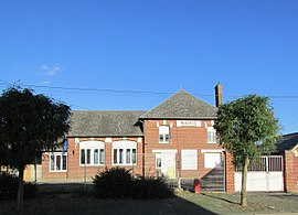 The town hall in Hancourt | |
show Location of Hancourt | |
 Hancourt | |
| Coordinates: 49°54′14″N 3°04′24″E / 49.9039°N 3.0733°ECoordinates: 49°54′14″N 3°04′24″E / 49.9039°N 3.0733°E | |
| Country | France |
| Region | Hauts-de-France |
| Department | Somme |
| Arrondissement | Péronne |
| Canton | Péronne |
| Intercommunality | Haute Somme |
| Government | |
| • Mayor (2020–2026) | Philippe Waree[1] |
| Area 1 | 4.06 km2 (1.57 sq mi) |
| Population (Jan. 2018)[2] | 90 |
| • Density | 22/km2 (57/sq mi) |
| Time zone | UTC+01:00 (CET) |
| • Summer (DST) | UTC+02:00 (CEST) |
| INSEE/Postal code | 80413 /80240 |
| Elevation | 82–110 m (269–361 ft) (avg. 102 m or 335 ft) |
| 1 French Land Register data, which excludes lakes, ponds, glaciers > 1 km2 (0.386 sq mi or 247 acres) and river estuaries. | |


Hancourt is a commune in the Somme department in Hauts-de-France in northern France.
Geography[]
Hancourt is situated on the D15 and D194 crossroads, some 10 miles (16 km) northwest of Saint-Quentin.
History[]
Hancourt was the French village to which the 22 survivors of the 2/4th Battalion of the Oxfordshire and Buckinghamshire Light Infantry retreated in spring 1918, after the Battalion was virtually wiped out in action on the Western Front.[3]
Population[]
| Year | 1962 | 1968 | 1975 | 1982 | 1990 | 1999 | 2006 |
|---|---|---|---|---|---|---|---|
| Population | 98 | 132 | 117 | 92 | 117 | 100 | 107 |
| From the year 1962 on: No double counting—residents of multiple communes (e.g. students and military personnel) are counted only once. | |||||||
See also[]
References[]
- ^ "Répertoire national des élus: les maires". data.gouv.fr, Plateforme ouverte des données publiques françaises (in French). 2 December 2020.
- ^ "Populations légales 2018". INSEE. 28 December 2020.
- ^ Bullock, Arthur (2009). Gloucestershire Between the Wars: A Memoir. The History Press. ISBN 978-0-7524-4793-3. (Page 61)
| Wikimedia Commons has media related to Hancourt. |
Categories:
- World War I sites in France
- Communes of Somme (department)
- Péronne arrondissement geography stubs