Hattencourt
Hattencourt | |
|---|---|
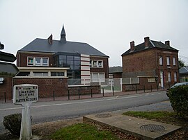 The town hall in Hattencourt | |
show Location of Hattencourt | |
 Hattencourt | |
| Coordinates: 49°46′12″N 2°47′20″E / 49.77°N 2.789°ECoordinates: 49°46′12″N 2°47′20″E / 49.77°N 2.789°E | |
| Country | France |
| Region | Hauts-de-France |
| Department | Somme |
| Arrondissement | Montdidier |
| Canton | Roye |
| Intercommunality | CC Grand Roye |
| Government | |
| • Mayor (2020–2026) | Sébastien Rubigny[1] |
| Area 1 | 3.61 km2 (1.39 sq mi) |
| Population (Jan. 2018)[2] | 292 |
| • Density | 81/km2 (210/sq mi) |
| Time zone | UTC+01:00 (CET) |
| • Summer (DST) | UTC+02:00 (CEST) |
| INSEE/Postal code | 80421 /80700 |
| Elevation | 78–92 m (256–302 ft) (avg. 86 m or 282 ft) |
| 1 French Land Register data, which excludes lakes, ponds, glaciers > 1 km2 (0.386 sq mi or 247 acres) and river estuaries. | |


Hattencourt is a commune in the Somme department in Hauts-de-France in northern France.
Geography[]
Hattencourt is situated on the D161 and D132 crossroads and about 100 yards from the A1 autoroute, some 30 miles (48 km) southeast of Amiens.
History[]
The village was first mentioned in the 14th century.
It was razed to the ground by the troops of Henri de la Tour d'Auvergne, Vicomte de Turenne in 1636.
As with many villages of the Somme, it was ruined by the bombardments of the First World War.
Population[]
| Year | 1962 | 1968 | 1975 | 1982 | 1990 | 1999 | 2006 |
|---|---|---|---|---|---|---|---|
| Population | 199 | 263 | 241 | 242 | 224 | 237 | 252 |
| From the year 1962 on: No double counting—residents of multiple communes (e.g. students and military personnel) are counted only once. | |||||||
See also[]
References[]
- ^ "Répertoire national des élus: les maires". data.gouv.fr, Plateforme ouverte des données publiques françaises (in French). 2 December 2020.
- ^ "Populations légales 2018". INSEE. 28 December 2020.
| Wikimedia Commons has media related to Hattencourt. |
Categories:
- Communes of Somme (department)
- Montdidier arrondissement geography stubs