Irles
Irles | |
|---|---|
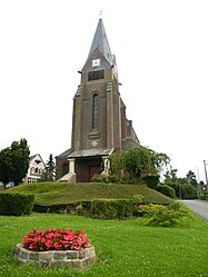 The church in Irles | |
show Location of Irles | |
 Irles | |
| Coordinates: 50°06′01″N 2°45′16″E / 50.1003°N 2.7544°ECoordinates: 50°06′01″N 2°45′16″E / 50.1003°N 2.7544°E | |
| Country | France |
| Region | Hauts-de-France |
| Department | Somme |
| Arrondissement | Péronne |
| Canton | Albert |
| Intercommunality | Pays du Coquelicot |
| Government | |
| • Mayor (2020–2026) | Régis Philippe |
| Area 1 | 5.38 km2 (2.08 sq mi) |
| Population (Jan. 2018)[1] | 120 |
| • Density | 22/km2 (58/sq mi) |
| Time zone | UTC+01:00 (CET) |
| • Summer (DST) | UTC+02:00 (CEST) |
| INSEE/Postal code | 80451 /80300 |
| Elevation | 82–132 m (269–433 ft) (avg. 101 m or 331 ft) |
| 1 French Land Register data, which excludes lakes, ponds, glaciers > 1 km2 (0.386 sq mi or 247 acres) and river estuaries. | |


Irles (French pronunciation: [iʁl]) is a commune in the Somme department in Hauts-de-France in northern France.
Geography[]
Irles is situated on the D163 road, some 10 miles (16 km) south of Arras, near the border with the département of the Pas-de-Calais.
History[]
Irles was the site of an action by the 1st Royal West Kent Regiment and the 12th Gloucestershire Regiment on 23 August 1918 during the Second Battle of Bapaume.
Population[]
| Year | 1962 | 1968 | 1975 | 1982 | 1990 | 1999 | 2006 |
|---|---|---|---|---|---|---|---|
| Population | 103 | 135 | 129 | 120 | 113 | 104 | 115 |
| From the year 1962 on: No double counting—residents of multiple communes (e.g. students and military personnel) are counted only once. | |||||||
See also[]
References[]
- Major CV Maloney, '"Invicta": with the 1st Battalion the Queen's Own Royal West Kent Regiment in the Great War', London: Nisbet & Co, 1923. ISBN 978-1-84342-541-0
- ^ "Populations légales 2018". INSEE. 28 December 2020.
| Wikimedia Commons has media related to Irles. |
Categories:
- Communes of Somme (department)
- Péronne arrondissement geography stubs