Le Cardonnois
Le Cardonnois | |
|---|---|
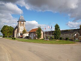 The church and town hall in Le Cardonnois | |
show Location of Le Cardonnois | |
 Le Cardonnois | |
| Coordinates: 49°37′42″N 2°28′51″E / 49.6283°N 2.4808°ECoordinates: 49°37′42″N 2°28′51″E / 49.6283°N 2.4808°E | |
| Country | France |
| Region | Hauts-de-France |
| Department | Somme |
| Arrondissement | Montdidier |
| Canton | Roye |
| Intercommunality | CC Grand Roye |
| Government | |
| • Mayor (2020–2026) | Jean-Luc Guyon[1] |
| Area 1 | 2.37 km2 (0.92 sq mi) |
| Population (Jan. 2018)[2] | 81 |
| • Density | 34/km2 (89/sq mi) |
| Time zone | UTC+01:00 (CET) |
| • Summer (DST) | UTC+02:00 (CEST) |
| INSEE/Postal code | 80174 /80500 |
| Elevation | 72–135 m (236–443 ft) (avg. 116 m or 381 ft) |
| 1 French Land Register data, which excludes lakes, ponds, glaciers > 1 km2 (0.386 sq mi or 247 acres) and river estuaries. | |


Le Cardonnois is a commune in the Somme department in Hauts-de-France in northern France.
Geography[]
The commune is situated on the D188 road, some 30 miles (48 km) south-southeast of Amiens.
Population[]
| Year | 1962 | 1968 | 1975 | 1982 | 1990 | 1999 | 2006 |
|---|---|---|---|---|---|---|---|
| Population | 13 | 32 | 38 | 37 | 41 | 50 | 75 |
| From the year 1962 on: No double counting—residents of multiple communes (e.g. students and military personnel) are counted only once. | |||||||
See also[]
References[]
- ^ "Répertoire national des élus: les maires". data.gouv.fr, Plateforme ouverte des données publiques françaises (in French). 2 December 2020. Retrieved 7 December 2020.
- ^ "Populations légales 2018". INSEE. 28 December 2020.
| Wikimedia Commons has media related to Le Cardonnois. |
Categories:
- Communes of Somme (department)
- Montdidier arrondissement geography stubs