Le Thillot
Le Thillot | |
|---|---|
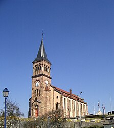 Saint-Jean-Baptiste | |
 Coat of arms | |
show Location of Le Thillot | |
 Le Thillot | |
| Coordinates: 47°52′51″N 6°45′57″E / 47.8808°N 6.7658°ECoordinates: 47°52′51″N 6°45′57″E / 47.8808°N 6.7658°E | |
| Country | France |
| Region | Grand Est |
| Department | Vosges |
| Arrondissement | Épinal |
| Canton | Le Thillot |
| Intercommunality | CC Ballons des Hautes-Vosges |
| Government | |
| • Mayor (2020–2026) | Michel Mourot |
| Area 1 | 15.14 km2 (5.85 sq mi) |
| Population (Jan. 2018)[1] | 3,405 |
| • Density | 220/km2 (580/sq mi) |
| Time zone | UTC+01:00 (CET) |
| • Summer (DST) | UTC+02:00 (CEST) |
| INSEE/Postal code | 88468 /88160 |
| Elevation | 468–950 m (1,535–3,117 ft) |
| 1 French Land Register data, which excludes lakes, ponds, glaciers > 1 km2 (0.386 sq mi or 247 acres) and river estuaries. | |


Le Thillot (French pronunciation: [lə tijo] (![]() listen)) is a commune in the Vosges department in Grand Est in northeastern France.
listen)) is a commune in the Vosges department in Grand Est in northeastern France.
See also[]
References[]
- ^ "Populations légales 2018". INSEE. 28 December 2020.
External links[]
| Wikimedia Commons has media related to Le Thillot. |
This Vosges geographical article is a stub. You can help Wikipedia by . |
Categories:
- Communes of Vosges (department)
- Vosges (department) geography stubs