Les Voivres
Les Voivres | |
|---|---|
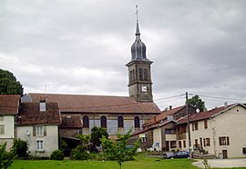 The church in Les Voivres | |
show Location of Les Voivres | |
 Les Voivres | |
| Coordinates: 48°01′55″N 6°17′43″E / 48.0319°N 6.2953°ECoordinates: 48°01′55″N 6°17′43″E / 48.0319°N 6.2953°E | |
| Country | France |
| Region | Grand Est |
| Department | Vosges |
| Arrondissement | Épinal |
| Canton | Le Val-d'Ajol |
| Intercommunality | CA Épinal |
| Government | |
| • Mayor (2020–2026) | Michel Fournier[1] |
| Area 1 | 12.81 km2 (4.95 sq mi) |
| Population (Jan. 2018)[2] | 304 |
| • Density | 24/km2 (61/sq mi) |
| Time zone | UTC+01:00 (CET) |
| • Summer (DST) | UTC+02:00 (CEST) |
| INSEE/Postal code | 88520 /88240 |
| Elevation | 280–422 m (919–1,385 ft) |
| 1 French Land Register data, which excludes lakes, ponds, glaciers > 1 km2 (0.386 sq mi or 247 acres) and river estuaries. | |


Les Voivres is a commune in the Vosges department in Grand Est in northeastern France.
Geography[]
The Côney forms most of the commune's northwestern border; a stream called le Jeandin, tributary of the Côney, forms the commune's northern border.
See also[]
References[]
- ^ "Répertoire national des élus: les maires". data.gouv.fr, Plateforme ouverte des données publiques françaises (in French). 2 December 2020.
- ^ "Populations légales 2018". INSEE. 28 December 2020.
| Wikimedia Commons has media related to Les Voivres. |
| show Authority control |
|---|
This Vosges geographical article is a stub. You can help Wikipedia by . |
Categories:
- Communes of Vosges (department)
- Vosges (department) geography stubs