Mazeley
Mazeley | |
|---|---|
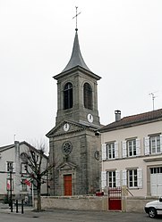 The church in Mazeley | |
show Location of Mazeley | |
 Mazeley | |
| Coordinates: 48°14′34″N 6°20′22″E / 48.2428°N 6.3394°ECoordinates: 48°14′34″N 6°20′22″E / 48.2428°N 6.3394°E | |
| Country | France |
| Region | Grand Est |
| Department | Vosges |
| Arrondissement | Épinal |
| Canton | Golbey |
| Intercommunality | CA Épinal |
| Government | |
| • Mayor (2008–2014) | Jean-Pierre Caytel |
| Area 1 | 10.39 km2 (4.01 sq mi) |
| Population (Jan. 2018)[1] | 265 |
| • Density | 26/km2 (66/sq mi) |
| Time zone | UTC+01:00 (CET) |
| • Summer (DST) | UTC+02:00 (CEST) |
| INSEE/Postal code | 88294 /88150 |
| Elevation | 320–415 m (1,050–1,362 ft) |
| 1 French Land Register data, which excludes lakes, ponds, glaciers > 1 km2 (0.386 sq mi or 247 acres) and river estuaries. | |


Mazeley is a commune in the Vosges department in Grand Est in northeastern France.
Geography[]
The village lies at the junction of three or four minor roads some 10 kilometres (6 mi) northwest of Épinal.
History[]
Several archaeological discoveries indicate that the area was occupied in Roman times. A section of paved roadway was unearthed in the local woods in 1861, followed in 1988 by the discovery of a Gallo-Roman road in the Chanot district. Also discovered in 1988 an old road visible over more than a kilometre in an area called Donzey Wood (Bois de Donzey) heading in the direction of Gigney[2]
Points of interest[]
See also[]
References[]
- ^ "Populations légales 2018". INSEE. 28 December 2020.
- ^ Provost (sous direction de), Michel (1988). Carte Archéologique de la Gaule. Vol 88. Paris: Académie des Inscriptions et Belles-Lettres. ISBN 2-87754-088-X.
|volume=has extra text (help)
| Wikimedia Commons has media related to Mazeley. |
This Vosges geographical article is a stub. You can help Wikipedia by . |
Categories:
- Communes of Vosges (department)
- Vosges (department) geography stubs