Pys
From Wikipedia, the free encyclopedia
Commune in Hauts-de-France, France
Pys | |
|---|---|
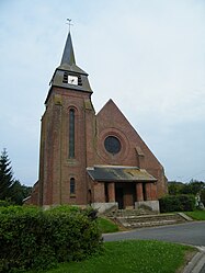 The church in Pys | |
 Pys  Pys | |
Coordinates:  50°05′16″N 2°45′27″E / 50.0878°N 2.7575°E / 50.0878; 2.7575Coordinates: 50°05′16″N 2°45′27″E / 50.0878°N 2.7575°E / 50.0878; 2.7575 50°05′16″N 2°45′27″E / 50.0878°N 2.7575°E / 50.0878; 2.7575Coordinates: 50°05′16″N 2°45′27″E / 50.0878°N 2.7575°E / 50.0878; 2.7575 | |
| Country | France |
| Region | Hauts-de-France |
| Department | Somme |
| Arrondissement | Péronne |
| Canton | Albert |
| Intercommunality | Pays du Coquelicot |
| Government | |
| • Mayor (2020–2026) | Vincent Philippe[1] |
| Area 1 | 5.05 km2 (1.95 sq mi) |
| Population (Jan. 2018)[2] | 121 |
| • Density | 24/km2 (62/sq mi) |
| Time zone | UTC+01:00 (CET) |
| • Summer (DST) | UTC+02:00 (CEST) |
| INSEE/Postal code | 80648 /80300 |
| Elevation | 87–133 m (285–436 ft) (avg. 115 m or 377 ft) |
| 1 French Land Register data, which excludes lakes, ponds, glaciers > 1 km2 (0.386 sq mi or 247 acres) and river estuaries. | |

Pys is a commune in the Somme département in Hauts-de-France in northern France.
Contents
Geography[]
Pys is situated on the D929 road, some 25 miles (40 km) north of Amiens, on the border with the Pas-de-Calais.
Population[]
| Year | Pop. | ±% p.a. |
|---|---|---|
| 1968 | 120 | — |
| 1975 | 110 | −1.24% |
| 1982 | 97 | −1.78% |
| 1990 | 100 | +0.38% |
| 1999 | 82 | −2.18% |
| 2007 | 97 | +2.12% |
| 2012 | 117 | +3.82% |
| 2017 | 120 | +0.51% |
| Source: INSEE[3] | ||
See also[]
References[]
- ^ "Répertoire national des élus: les maires". data.gouv.fr, Plateforme ouverte des données publiques françaises (in French). 2 December 2020.
- ^ "Populations légales 2018". INSEE. 28 December 2020.
- ^ Population en historique depuis 1968, INSEE
| Wikimedia Commons has media related to Pys. |
show
Communes of the Somme department | |
|---|---|
|
This Arrondissement of Péronne geographical article is a stub. You can help Wikipedia by . |
Retrieved from ""
Categories:
- Communes of Somme (department)
- Péronne arrondissement geography stubs
Hidden categories:
- CS1 French-language sources (fr)
- Articles with short description
- Short description is different from Wikidata
- Infobox mapframe without OSM relation ID on Wikidata
- Coordinates on Wikidata
- Pages using infobox settlement with image map1 but not image map
- Commons category link from Wikidata
- Articles with BNF identifiers
- All stub articles
- Pages using the Kartographer extension