Surcamps
Surcamps | |
|---|---|
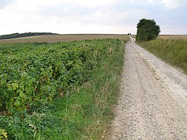 The old Roman road | |
show Location of Surcamps | |
 Surcamps | |
| Coordinates: 50°04′13″N 2°04′32″E / 50.0703°N 2.0756°ECoordinates: 50°04′13″N 2°04′32″E / 50.0703°N 2.0756°E | |
| Country | France |
| Region | Hauts-de-France |
| Department | Somme |
| Arrondissement | Amiens |
| Canton | Flixecourt |
| Intercommunality | CC Nièvre et Somme |
| Government | |
| • Mayor (2020–2026) | Dominique Boullet |
| Area 1 | 2.97 km2 (1.15 sq mi) |
| Population (Jan. 2018)[1] | 64 |
| • Density | 22/km2 (56/sq mi) |
| Time zone | UTC+01:00 (CET) |
| • Summer (DST) | UTC+02:00 (CEST) |
| INSEE/Postal code | 80742 /80620 |
| Elevation | 63–117 m (207–384 ft) (avg. 110 m or 360 ft) |
| 1 French Land Register data, which excludes lakes, ponds, glaciers > 1 km2 (0.386 sq mi or 247 acres) and river estuaries. | |


Surcamps is a commune located in the Somme department, Hauts-de-France, northern France.
Geography[]
Surcamps is situated 10 miles (16 km) southeast of Amiens, on the D216e road, by the side of the old Roman road, the Chaussée Brunehaut.
Population[]
| Year | 1962 | 1968 | 1975 | 1982 | 1990 | 1999 | 2006 |
|---|---|---|---|---|---|---|---|
| Population | 60 | 67 | 82 | 73 | 64 | 56 | 69 |
| From the year 1962 on: No double counting—residents of multiple communes (e.g. students and military personnel) are counted only once. | |||||||
Places of interest[]
- The nineteenth century church
- Traces of Gallo-Roman settlements
- The wood of Coroy, where the well-preserved remains of a Nazi V1 rocket launch site is situated. Built by French prisoners in the summer of 1943, it was bombed 12 times by the Allies from December 1943 until April 1944.[2]
See also[]
References[]
- ^ "Populations légales 2018". INSEE. 28 December 2020.
- ^ Source : Quotidien Le Courrier Picard, édition de la Somme, du 4 novembre 2007.
| Wikimedia Commons has media related to Surcamps. |
Categories:
- Communes of Somme (department)
- Amiens arrondissement geography stubs