Talmas
Talmas | |
|---|---|
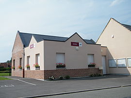 The town hall in Talmas | |
show Location of Talmas | |
 Talmas | |
| Coordinates: 50°01′50″N 2°19′38″E / 50.0306°N 2.3272°ECoordinates: 50°01′50″N 2°19′38″E / 50.0306°N 2.3272°E | |
| Country | France |
| Region | Hauts-de-France |
| Department | Somme |
| Arrondissement | Amiens |
| Canton | Corbie |
| Intercommunality | CC Territoire Nord Picardie |
| Government | |
| • Mayor (2020–2026) | Patrick Blocklet |
| Area 1 | 19.2 km2 (7.4 sq mi) |
| Population (Jan. 2018)[1] | 1,069 |
| • Density | 56/km2 (140/sq mi) |
| Time zone | UTC+01:00 (CET) |
| • Summer (DST) | UTC+02:00 (CEST) |
| INSEE/Postal code | 80746 /80260 |
| Elevation | 87–154 m (285–505 ft) (avg. 145 m or 476 ft) |
| 1 French Land Register data, which excludes lakes, ponds, glaciers > 1 km2 (0.386 sq mi or 247 acres) and river estuaries. | |


Talmas is a commune in the Somme department in Hauts-de-France in northern France.
Geography[]
Talmas is situated 11 miles (18 km) north of Amiens, on the N25 and D60 crossroads
Population[]
| Year | 1962 | 1968 | 1975 | 1982 | 1990 | 1999 | 2006 |
|---|---|---|---|---|---|---|---|
| Population | 448 | 554 | 787 | 1027 | 123 | 1053 | 1104 |
| From the year 1962 on: No double counting—residents of multiple communes (e.g. students and military personnel) are counted only once. | |||||||
Places of interest[]
Known for the « muches », a vast network of natural and man-made galleries in the limestone, where the local population hid and lived during the Spanish occupation in the 16th century.
See also[]
References[]
- ^ "Populations légales 2018". INSEE. 28 December 2020.
External links[]
| Wikimedia Commons has media related to Talmas. |
- Official website of the commune (in French)
- The Muches (in French)
Categories:
- Communes of Somme (department)
- Amiens arrondissement geography stubs