Autrey, Vosges
Autrey | |
|---|---|
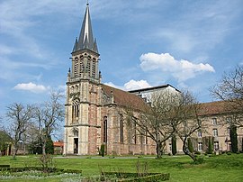 The abbey and gardens in Autrey | |
show Location of Autrey | |
 Autrey | |
| Coordinates: 48°17′50″N 6°41′24″E / 48.2972°N 6.69°ECoordinates: 48°17′50″N 6°41′24″E / 48.2972°N 6.69°E | |
| Country | France |
| Region | Grand Est |
| Department | Vosges |
| Arrondissement | Épinal |
| Canton | Saint-Dié-des-Vosges-1 |
| Intercommunality | CC Région Rambervillers |
| Government | |
| • Mayor (2014-2020) | Cécile Chaumont |
| Area 1 | 17.42 km2 (6.73 sq mi) |
| Population (Jan. 2018)[1] | 282 |
| • Density | 16/km2 (42/sq mi) |
| Time zone | UTC+01:00 (CET) |
| • Summer (DST) | UTC+02:00 (CEST) |
| INSEE/Postal code | 88021 /88700 |
| Elevation | 306–535 m (1,004–1,755 ft) (avg. 320 m or 1,050 ft) |
| 1 French Land Register data, which excludes lakes, ponds, glaciers > 1 km2 (0.386 sq mi or 247 acres) and river estuaries. | |


Autrey is a commune in the Vosges department in Grand Est in northeastern France.
Geography[]
The village lies in the north-western part of the commune, on the right bank of the Mortagne, which forms all of the commune's western and south-western borders.
Points of interest[]
See also[]
References[]
- ^ "Populations légales 2018". INSEE. 28 December 2020.
| Wikimedia Commons has media related to Autrey (Vosges). |
This Vosges geographical article is a stub. You can help Wikipedia by . |
Categories:
- Communes of Vosges (department)
- Vosges (department) geography stubs