Ayguetinte
Ayguetinte | |
|---|---|
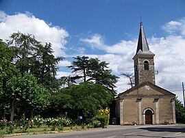 The church in Ayguetinte | |
show Location of Ayguetinte | |
 Ayguetinte | |
| Coordinates: 43°50′06″N 0°25′41″E / 43.835°N 0.4281°ECoordinates: 43°50′06″N 0°25′41″E / 43.835°N 0.4281°E | |
| Country | France |
| Region | Occitanie |
| Department | Gers |
| Arrondissement | Auch |
| Canton | Baïse-Armagnac |
| Intercommunality | |
| Government | |
| • Mayor (2020–2026) | Francis Ballérini |
| Area 1 | 6.31 km2 (2.44 sq mi) |
| Population (Jan. 2018)[1] | 162 |
| • Density | 26/km2 (66/sq mi) |
| Time zone | UTC+01:00 (CET) |
| • Summer (DST) | UTC+02:00 (CEST) |
| INSEE/Postal code | 32024 /32410 |
| Elevation | 96–203 m (315–666 ft) (avg. 113 m or 371 ft) |
| 1 French Land Register data, which excludes lakes, ponds, glaciers > 1 km2 (0.386 sq mi or 247 acres) and river estuaries. | |


Ayguetinte (French pronunciation: [ɛɡtɛ̃t]; Aigatinta (colored water) in Occitan language) is a commune in the Gers department in southwestern France.
Geography[]

Ayguetinte and its surrounding communes
Population[]
| Year | Pop. | ±% |
|---|---|---|
| 1962 | 222 | — |
| 1968 | 199 | −10.4% |
| 1975 | 173 | −13.1% |
| 1982 | 172 | −0.6% |
| 1990 | 162 | −5.8% |
| 1999 | 152 | −6.2% |
| 2008 | 180 | +18.4% |
| 2014 | 165 | −8.3% |
See also[]
- Communes of the Gers department
References[]
- ^ "Populations légales 2018". INSEE. 28 December 2020.
| Wikimedia Commons has media related to Ayguetinte. |
| show Communes of the Gers department |
|---|
This Gers geographical article is a stub. You can help Wikipedia by . |
Categories:
- Communes of Gers
- Gers geography stubs