Badecon-le-Pin
Badecon-le-Pin | |
|---|---|
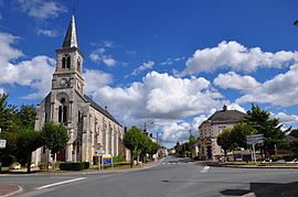 The church and the main road in Badecon-le-Pin | |
show Location of Badecon-le-Pin | |
 Badecon-le-Pin | |
| Coordinates: 46°32′28″N 1°35′34″E / 46.5411°N 1.5928°ECoordinates: 46°32′28″N 1°35′34″E / 46.5411°N 1.5928°E | |
| Country | France |
| Region | Centre-Val de Loire |
| Department | Indre |
| Arrondissement | Châteauroux |
| Canton | Argenton-sur-Creuse |
| Government | |
| • Mayor (2020–2026) | François Broggi[1] |
| Area 1 | 9.88 km2 (3.81 sq mi) |
| Population (Jan. 2018)[2] | 759 |
| • Density | 77/km2 (200/sq mi) |
| Time zone | UTC+01:00 (CET) |
| • Summer (DST) | UTC+02:00 (CEST) |
| INSEE/Postal code | 36158 /36200 |
| Elevation | 111–259 m (364–850 ft) (avg. 200 m or 660 ft) |
| 1 French Land Register data, which excludes lakes, ponds, glaciers > 1 km2 (0.386 sq mi or 247 acres) and river estuaries. | |


Badecon-le-Pin is a commune in the Indre département in central France.
Population[]
|
|
See also[]
- Communes of the Indre department
References[]
- ^ "Répertoire national des élus: les maires". data.gouv.fr, Plateforme ouverte des données publiques françaises (in French). 2 December 2020.
- ^ "Populations légales 2018". INSEE. 28 December 2020.
| Wikimedia Commons has media related to Badecon-le-Pin. |
| show Communes of the Indre department |
|---|
This Indre geographical article is a stub. You can help Wikipedia by . |
Categories:
- Communes of Indre
- Indre geography stubs