Palluau-sur-Indre
Palluau-sur-Indre | |
|---|---|
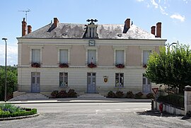 Town hall | |
 Coat of arms | |
show Location of Palluau-sur-Indre | |
 Palluau-sur-Indre | |
| Coordinates: 46°56′41″N 1°18′45″E / 46.9447°N 1.3125°ECoordinates: 46°56′41″N 1°18′45″E / 46.9447°N 1.3125°E | |
| Country | France |
| Region | Centre-Val de Loire |
| Department | Indre |
| Arrondissement | Châteauroux |
| Canton | Buzançais |
| Government | |
| • Mayor (2020–2026) | Marc Rouffy |
| Area 1 | 41.55 km2 (16.04 sq mi) |
| Population (Jan. 2018)[1] | 790 |
| • Density | 19/km2 (49/sq mi) |
| Time zone | UTC+01:00 (CET) |
| • Summer (DST) | UTC+02:00 (CEST) |
| INSEE/Postal code | 36149 /36500 |
| Elevation | 91–196 m (299–643 ft) (avg. 177 m or 581 ft) |
| 1 French Land Register data, which excludes lakes, ponds, glaciers > 1 km2 (0.386 sq mi or 247 acres) and river estuaries. | |


Palluau-sur-Indre (French pronunciation: [palɥo syʁ ɛ̃dʁ], literally Palluau on Indre) is a commune in the Indre department in central France.
Population[]
|
|
See also[]
- Communes of the Indre department
References[]
- ^ "Populations légales 2018". INSEE. 28 December 2020.
| Wikimedia Commons has media related to Palluau-sur-Indre. |
| show Communes of the Indre department |
|---|
| show Authority control |
|---|
This Indre geographical article is a stub. You can help Wikipedia by . |
Categories:
- Communes of Indre
- Indre geography stubs