Condé, Indre
Condé | |
|---|---|
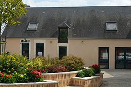 The town hall in Condé | |
Location of Condé  | |
 Condé | |
| Coordinates: 46°52′47″N 1°59′12″E / 46.8797°N 1.9867°ECoordinates: 46°52′47″N 1°59′12″E / 46.8797°N 1.9867°E | |
| Country | France |
| Region | Centre-Val de Loire |
| Department | Indre |
| Arrondissement | Issoudun |
| Canton | La Châtre |
| Intercommunality | Champagne Boischauts |
| Government | |
| • Mayor (2020–2026) | Christian Lafond[1] |
| Area 1 | 23.82 km2 (9.20 sq mi) |
| Population (Jan. 2018)[2] | 237 |
| • Density | 9.9/km2 (26/sq mi) |
| Time zone | UTC+01:00 (CET) |
| • Summer (DST) | UTC+02:00 (CEST) |
| INSEE/Postal code | 36059 /36100 |
| Elevation | 130–168 m (427–551 ft) (avg. 160 m or 520 ft) |
| 1 French Land Register data, which excludes lakes, ponds, glaciers > 1 km2 (0.386 sq mi or 247 acres) and river estuaries. | |


Condé is a commune in the Indre department in central France.
Population[]
|
|
See also[]
- Communes of the Indre department
References[]
- ^ "Répertoire national des élus: les maires". data.gouv.fr, Plateforme ouverte des données publiques françaises (in French). 9 August 2021.
- ^ "Populations légales 2018". The National Institute of Statistics and Economic Studies. 28 December 2020.
| Wikimedia Commons has media related to Condé (Indre). |
This Indre geographical article is a stub. You can help Wikipedia by . |
Categories:
- Communes of Indre
- Indre geography stubs