La Buxerette
La Buxerette | |
|---|---|
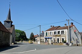 The church square in La Buxerette | |
show Location of La Buxerette | |
 La Buxerette | |
| Coordinates: 46°29′43″N 1°48′11″E / 46.4953°N 1.8031°ECoordinates: 46°29′43″N 1°48′11″E / 46.4953°N 1.8031°E | |
| Country | France |
| Region | Centre-Val de Loire |
| Department | Indre |
| Arrondissement | La Châtre |
| Canton | Neuvy-Saint-Sépulchre |
| Intercommunality | Marche berrichonne |
| Government | |
| • Mayor (2021–2026) | Philippe Allely[1] |
| Area 1 | 10.99 km2 (4.24 sq mi) |
| Population (Jan. 2018)[2] | 112 |
| • Density | 10/km2 (26/sq mi) |
| Time zone | UTC+01:00 (CET) |
| • Summer (DST) | UTC+02:00 (CEST) |
| INSEE/Postal code | 36028 /36140 |
| Elevation | 282–387 m (925–1,270 ft) (avg. 372 m or 1,220 ft) |
| 1 French Land Register data, which excludes lakes, ponds, glaciers > 1 km2 (0.386 sq mi or 247 acres) and river estuaries. | |


La Buxerette is a commune in the Indre department in central France.
Geography[]
The Bouzanne forms the commune's western border.
Population[]
|
|
See also[]
- Communes of the Indre department
References[]
- ^ "Répertoire national des élus: les maires". data.gouv.fr, Plateforme ouverte des données publiques françaises (in French). 9 August 2021.
- ^ "Populations légales 2018". INSEE. 28 December 2020.
| Wikimedia Commons has media related to La Buxerette. |
| show Communes of the Indre department |
|---|
This Indre geographical article is a stub. You can help Wikipedia by . |
Categories:
- Communes of Indre
- Indre geography stubs