Lurais
Lurais | |
|---|---|
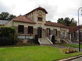 The town hall in Lurais | |
show Location of Lurais | |
 Lurais | |
| Coordinates: 46°42′19″N 0°57′05″E / 46.7053°N 0.9514°ECoordinates: 46°42′19″N 0°57′05″E / 46.7053°N 0.9514°E | |
| Country | France |
| Region | Centre-Val de Loire |
| Department | Indre |
| Arrondissement | Le Blanc |
| Canton | Le Blanc |
| Intercommunality | Brenne Val de Creuse |
| Government | |
| • Mayor (2020–2026) | Alain Jacquet[1] |
| Area 1 | 13.61 km2 (5.25 sq mi) |
| Population (Jan. 2018)[2] | 241 |
| • Density | 18/km2 (46/sq mi) |
| Time zone | UTC+01:00 (CET) |
| • Summer (DST) | UTC+02:00 (CEST) |
| INSEE/Postal code | 36104 /36220 |
| Elevation | 67–134 m (220–440 ft) (avg. 80 m or 260 ft) |
| 1 French Land Register data, which excludes lakes, ponds, glaciers > 1 km2 (0.386 sq mi or 247 acres) and river estuaries. | |


Lurais (French pronunciation: [lyʁɛ]) is a commune in the Indre department in central France.
Geography[]
The commune is located in the parc naturel régional de la Brenne.
Population[]
|
|
See also[]
- Communes of the Indre department
References[]
- ^ "Répertoire national des élus: les maires". data.gouv.fr, Plateforme ouverte des données publiques françaises (in French). 2 December 2020.
- ^ "Populations légales 2018". INSEE. 28 December 2020.
| Wikimedia Commons has media related to Lurais. |
| show Communes of the Indre department |
|---|
This Indre geographical article is a stub. You can help Wikipedia by . |
Categories:
- Communes of Indre
- Indre geography stubs