Urciers
Urciers | |
|---|---|
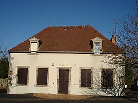 The town hall in Urciers | |
show Location of Urciers | |
 Urciers | |
| Coordinates: 46°32′10″N 2°07′54″E / 46.5361°N 2.1317°ECoordinates: 46°32′10″N 2°07′54″E / 46.5361°N 2.1317°E | |
| Country | France |
| Region | Centre-Val de Loire |
| Department | Indre |
| Arrondissement | La Châtre |
| Canton | La Châtre |
| Government | |
| • Mayor (2020–2026) | Alain Guillemain |
| Area 1 | 19.02 km2 (7.34 sq mi) |
| Population (Jan. 2018)[1] | 249 |
| • Density | 13/km2 (34/sq mi) |
| Time zone | UTC+01:00 (CET) |
| • Summer (DST) | UTC+02:00 (CEST) |
| INSEE/Postal code | 36227 /36160 |
| Elevation | 247–363 m (810–1,191 ft) (avg. 280 m or 920 ft) |
| 1 French Land Register data, which excludes lakes, ponds, glaciers > 1 km2 (0.386 sq mi or 247 acres) and river estuaries. | |


Urciers (French pronunciation: [yʁsje]) is a commune in the Indre department in central France.
Population[]
| Year | Pop. | ±% |
|---|---|---|
| 1793 | 600 | — |
| 1800 | 325 | −45.8% |
| 1806 | 397 | +22.2% |
| 1821 | 483 | +21.7% |
| 1831 | 546 | +13.0% |
| 1836 | 610 | +11.7% |
| 1841 | 577 | −5.4% |
| 1846 | 635 | +10.1% |
| 1851 | 690 | +8.7% |
| 1856 | 688 | −0.3% |
| 1861 | 735 | +6.8% |
| 1866 | 757 | +3.0% |
| 1872 | 762 | +0.7% |
| 1876 | 818 | +7.3% |
| 1881 | 941 | +15.0% |
| 1886 | 944 | +0.3% |
| 1891 | 947 | +0.3% |
| 1896 | 900 | −5.0% |
| 1901 | 920 | +2.2% |
| 1906 | 975 | +6.0% |
| 1911 | 892 | −8.5% |
| 1921 | 760 | −14.8% |
| 1926 | 732 | −3.7% |
| 1931 | 690 | −5.7% |
| 1936 | 679 | −1.6% |
| 1946 | 612 | −9.9% |
| 1954 | 537 | −12.3% |
| 1962 | 503 | −6.3% |
| 1968 | 448 | −10.9% |
| 1975 | 389 | −13.2% |
| 1982 | 332 | −14.7% |
| 1990 | 266 | −19.9% |
| 1999 | 260 | −2.3% |
| 2006 | 267 | +2.7% |
| 2009 | 267 | +0.0% |
See also[]
- Communes of the Indre department
References[]
- ^ "Populations légales 2018". INSEE. 28 December 2020.
| Wikimedia Commons has media related to Urciers. |
| show Communes of the Indre department |
|---|
This Indre geographical article is a stub. You can help Wikipedia by . |
Categories:
- Communes of Indre
- Indre geography stubs