Brion, Indre
Brion | |
|---|---|
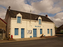 The town hall in Brion | |
show Location of Brion | |
 Brion | |
| Coordinates: 46°57′28″N 1°43′42″E / 46.9578°N 1.7283°ECoordinates: 46°57′28″N 1°43′42″E / 46.9578°N 1.7283°E | |
| Country | France |
| Region | Centre-Val de Loire |
| Department | Indre |
| Arrondissement | Châteauroux |
| Canton | Levroux |
| Government | |
| • Mayor (2020–2026) | Thierry Fourré[1] |
| Area 1 | 44.2 km2 (17.1 sq mi) |
| Population (Jan. 2018)[2] | 589 |
| • Density | 13/km2 (35/sq mi) |
| Time zone | UTC+01:00 (CET) |
| • Summer (DST) | UTC+02:00 (CEST) |
| INSEE/Postal code | 36026 /36110 |
| Elevation | 158–222 m (518–728 ft) (avg. 180 m or 590 ft) |
| 1 French Land Register data, which excludes lakes, ponds, glaciers > 1 km2 (0.386 sq mi or 247 acres) and river estuaries. | |


Brion (French pronunciation: [bʁijɔ̃] (![]() listen)) is a commune in the Indre department in central France.
listen)) is a commune in the Indre department in central France.
Population[]
|
|
See also[]
- Communes of the Indre department
References[]
- ^ "Répertoire national des élus: les maires". data.gouv.fr, Plateforme ouverte des données publiques françaises (in French). 2 December 2020.
- ^ "Populations légales 2018". INSEE. 28 December 2020.
| Wikimedia Commons has media related to Brion (Indre). |
| show Communes of the Indre department |
|---|
This Indre geographical article is a stub. You can help Wikipedia by . |
Categories:
- Communes of Indre
- Indre geography stubs