La Chapelle-Saint-Laurian
La Chapelle-Saint-Laurian | |
|---|---|
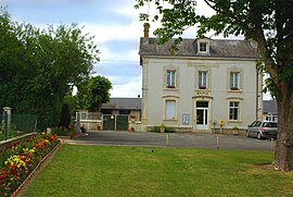 Town hall | |
show Location of La Chapelle-Saint-Laurian | |
 La Chapelle-Saint-Laurian | |
| Coordinates: 47°03′47″N 1°47′02″E / 47.0631°N 1.7839°ECoordinates: 47°03′47″N 1°47′02″E / 47.0631°N 1.7839°E | |
| Country | France |
| Region | Centre-Val de Loire |
| Department | Indre |
| Arrondissement | Issoudun |
| Canton | Levroux |
| Government | |
| • Mayor (2008–2014) | René Gauthier |
| Area 1 | 9.82 km2 (3.79 sq mi) |
| Population (Jan. 2018)[1] | 144 |
| • Density | 15/km2 (38/sq mi) |
| Time zone | UTC+01:00 (CET) |
| • Summer (DST) | UTC+02:00 (CEST) |
| INSEE/Postal code | 36041 /36150 |
| Elevation | 125–174 m (410–571 ft) (avg. 200 m or 660 ft) |
| 1 French Land Register data, which excludes lakes, ponds, glaciers > 1 km2 (0.386 sq mi or 247 acres) and river estuaries. | |


La Chapelle-Saint-Laurian is a commune in the Indre department in central France.
Population[]
|
|
See also[]
- Communes of the Indre department
References[]
- ^ "Populations légales 2018". INSEE. 28 December 2020.
| Wikimedia Commons has media related to La Chapelle-Saint-Laurian. |
| show Communes of the Indre department |
|---|
This Indre geographical article is a stub. You can help Wikipedia by . |
Categories:
- Communes of Indre
- Indre geography stubs