Buxeuil, Indre
Buxeuil | |
|---|---|
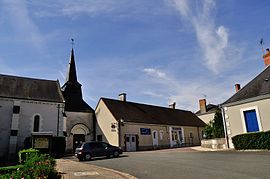 The main square in Buxeuil | |
show Location of Buxeuil | |
 Buxeuil | |
| Coordinates: 47°08′02″N 1°41′15″E / 47.1339°N 1.6875°ECoordinates: 47°08′02″N 1°41′15″E / 47.1339°N 1.6875°E | |
| Country | France |
| Region | Centre-Val de Loire |
| Department | Indre |
| Arrondissement | Issoudun |
| Canton | Levroux |
| Intercommunality | Champagne Boischauts |
| Government | |
| • Mayor (2008–2014) | Daniel Thénot |
| Area 1 | 19.75 km2 (7.63 sq mi) |
| Population (Jan. 2018)[1] | 224 |
| • Density | 11/km2 (29/sq mi) |
| Time zone | UTC+01:00 (CET) |
| • Summer (DST) | UTC+02:00 (CEST) |
| INSEE/Postal code | 36029 /36150 |
| Elevation | 97–161 m (318–528 ft) (avg. 110 m or 360 ft) |
| 1 French Land Register data, which excludes lakes, ponds, glaciers > 1 km2 (0.386 sq mi or 247 acres) and river estuaries. | |


Buxeuil is a commune in the Indre department in central France.
Population[]
|
|
See also[]
- Communes of the Indre department
References[]
- ^ "Populations légales 2018". INSEE. 28 December 2020.
| Wikimedia Commons has media related to Buxeuil (Indre). |
| show Communes of the Indre department |
|---|
| show Authority control |
|---|
This Indre geographical article is a stub. You can help Wikipedia by . |
Categories:
- Communes of Indre
- Indre geography stubs