Baraize
Baraize | |
|---|---|
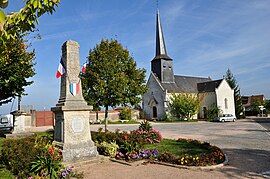 The church and war memorial in Baraize | |
show Location of Baraize | |
 Baraize | |
| Coordinates: 46°29′22″N 1°33′45″E / 46.4894°N 1.5625°ECoordinates: 46°29′22″N 1°33′45″E / 46.4894°N 1.5625°E | |
| Country | France |
| Region | Centre-Val de Loire |
| Department | Indre |
| Arrondissement | Châteauroux |
| Canton | Argenton-sur-Creuse |
| Government | |
| • Mayor (2020–2026) | Lionnel Perrot[1] |
| Area 1 | 16.39 km2 (6.33 sq mi) |
| Population (Jan. 2018)[2] | 357 |
| • Density | 22/km2 (56/sq mi) |
| Time zone | UTC+01:00 (CET) |
| • Summer (DST) | UTC+02:00 (CEST) |
| INSEE/Postal code | 36012 /36270 |
| Elevation | 123–292 m (404–958 ft) (avg. 244 m or 801 ft) |
| 1 French Land Register data, which excludes lakes, ponds, glaciers > 1 km2 (0.386 sq mi or 247 acres) and river estuaries. | |


Baraize (French pronunciation: [baʁɛz]) is a commune in the Indre département in central France.
Population[]
|
|
See also[]
- Communes of the Indre department
References[]
- ^ "Répertoire national des élus: les maires". data.gouv.fr, Plateforme ouverte des données publiques françaises (in French). 2 December 2020.
- ^ "Populations légales 2018". INSEE. 28 December 2020.
| Wikimedia Commons has media related to Baraize. |
| show Communes of the Indre department |
|---|
| show Authority control |
|---|
This Indre geographical article is a stub. You can help Wikipedia by . |
Categories:
- Communes of Indre
- Indre geography stubs