Buxières-d'Aillac
Buxières-d'Aillac | |
|---|---|
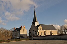 The church in Buxières-d'Aillac | |
show Location of Buxières-d'Aillac | |
 Buxières-d'Aillac | |
| Coordinates: 46°38′21″N 1°45′12″E / 46.6392°N 1.7533°ECoordinates: 46°38′21″N 1°45′12″E / 46.6392°N 1.7533°E | |
| Country | France |
| Region | Centre-Val de Loire |
| Department | Indre |
| Arrondissement | La Châtre |
| Canton | Neuvy-Saint-Sépulchre |
| Government | |
| • Mayor (2020–2026) | Didier Guenin |
| Area 1 | 25.75 km2 (9.94 sq mi) |
| Population (Jan. 2018)[1] | 250 |
| • Density | 9.7/km2 (25/sq mi) |
| Time zone | UTC+01:00 (CET) |
| • Summer (DST) | UTC+02:00 (CEST) |
| INSEE/Postal code | 36030 /36230 |
| Elevation | 155–222 m (509–728 ft) (avg. 187 m or 614 ft) |
| 1 French Land Register data, which excludes lakes, ponds, glaciers > 1 km2 (0.386 sq mi or 247 acres) and river estuaries. | |


Buxières-d'Aillac (French pronunciation: [byksjɛʁ dajak]) is a commune in the Indre department in central France.
Geography[]
The commune is traversed by the river Bouzanne.
Population[]
| Year | Pop. | ±% |
|---|---|---|
| 1793 | 353 | — |
| 1800 | 310 | −12.2% |
| 1806 | 336 | +8.4% |
| 1821 | 400 | +19.0% |
| 1831 | 363 | −9.3% |
| 1836 | 389 | +7.2% |
| 1841 | 360 | −7.5% |
| 1846 | 390 | +8.3% |
| 1851 | 380 | −2.6% |
| 1856 | 382 | +0.5% |
| 1861 | 372 | −2.6% |
| 1866 | 405 | +8.9% |
| 1872 | 430 | +6.2% |
| 1876 | 409 | −4.9% |
| 1881 | 446 | +9.0% |
| 1886 | 461 | +3.4% |
| 1891 | 463 | +0.4% |
| 1896 | 472 | +1.9% |
| 1901 | 456 | −3.4% |
| 1906 | 451 | −1.1% |
| 1911 | 448 | −0.7% |
| 1921 | 422 | −5.8% |
| 1926 | 389 | −7.8% |
| 1931 | 369 | −5.1% |
| 1936 | 377 | +2.2% |
| 1946 | 311 | −17.5% |
| 1954 | 312 | +0.3% |
| 1962 | 313 | +0.3% |
| 1968 | 273 | −12.8% |
| 1975 | 223 | −18.3% |
| 1982 | 217 | −2.7% |
| 1990 | 246 | +13.4% |
| 1999 | 217 | −11.8% |
| 2009 | 223 | +2.8% |
See also[]
- Communes of the Indre department
References[]
- ^ "Populations légales 2018". INSEE. 28 December 2020.
| Wikimedia Commons has media related to Buxières-d'Aillac. |
| show Communes of the Indre department |
|---|
This Indre geographical article is a stub. You can help Wikipedia by . |
Categories:
- Communes of Indre
- Indre geography stubs