Bazaiges
Bazaiges | |
|---|---|
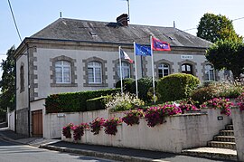 Town hall | |
show Location of Bazaiges | |
 Bazaiges | |
| Coordinates: 46°29′59″N 1°32′03″E / 46.4997°N 1.5342°ECoordinates: 46°29′59″N 1°32′03″E / 46.4997°N 1.5342°E | |
| Country | France |
| Region | Centre-Val de Loire |
| Department | Indre |
| Arrondissement | Châteauroux |
| Canton | Argenton-sur-Creuse |
| Government | |
| • Mayor (2008–2014) | Bernard Lelong |
| Area 1 | 18.37 km2 (7.09 sq mi) |
| Population (Jan. 2018)[1] | 200 |
| • Density | 11/km2 (28/sq mi) |
| Time zone | UTC+01:00 (CET) |
| • Summer (DST) | UTC+02:00 (CEST) |
| INSEE/Postal code | 36014 /36270 |
| Elevation | 175–280 m (574–919 ft) (avg. 265 m or 869 ft) |
| 1 French Land Register data, which excludes lakes, ponds, glaciers > 1 km2 (0.386 sq mi or 247 acres) and river estuaries. | |


Bazaiges is a commune in the Indre département in central France.
Geography[]
The river Abloux forms part of the commune's southwestern border.
Population[]
|
|
See also[]
- Communes of the Indre department
References[]
- ^ "Populations légales 2018". INSEE. 28 December 2020.
| Wikimedia Commons has media related to Bazaiges. |
| show Communes of the Indre department |
|---|
| show Authority control |
|---|
This Indre geographical article is a stub. You can help Wikipedia by . |
Categories:
- Communes of Indre
- Indre geography stubs