Tranzault
Tranzault | |
|---|---|
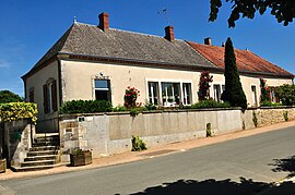 Town hall | |
show Location of Tranzault | |
 Tranzault | |
| Coordinates: 46°37′54″N 1°51′03″E / 46.6317°N 1.8508°ECoordinates: 46°37′54″N 1°51′03″E / 46.6317°N 1.8508°E | |
| Country | France |
| Region | Centre-Val de Loire |
| Department | Indre |
| Arrondissement | La Châtre |
| Canton | Neuvy-Saint-Sépulchre |
| Government | |
| • Mayor (2008–2014) | Christian Paguignon |
| Area 1 | 17.97 km2 (6.94 sq mi) |
| Population (Jan. 2018)[1] | 352 |
| • Density | 20/km2 (51/sq mi) |
| Time zone | UTC+01:00 (CET) |
| • Summer (DST) | UTC+02:00 (CEST) |
| INSEE/Postal code | 36226 /36230 |
| Elevation | 166–238 m (545–781 ft) (avg. 228 m or 748 ft) |
| 1 French Land Register data, which excludes lakes, ponds, glaciers > 1 km2 (0.386 sq mi or 247 acres) and river estuaries. | |


Tranzault is a commune in the Indre department in central France.
Geography[]
The commune is traversed by the river Bouzanne.
Population[]
| Year | Pop. | ±% |
|---|---|---|
| 1793 | 600 | — |
| 1800 | 467 | −22.2% |
| 1806 | 485 | +3.9% |
| 1821 | 518 | +6.8% |
| 1831 | 521 | +0.6% |
| 1836 | 536 | +2.9% |
| 1841 | 525 | −2.1% |
| 1846 | 525 | +0.0% |
| 1851 | 496 | −5.5% |
| 1856 | 503 | +1.4% |
| 1861 | 548 | +8.9% |
| 1866 | 593 | +8.2% |
| 1872 | 612 | +3.2% |
| 1876 | 616 | +0.7% |
| 1881 | 633 | +2.8% |
| 1886 | 637 | +0.6% |
| 1891 | 667 | +4.7% |
| 1896 | 635 | −4.8% |
| 1901 | 648 | +2.0% |
| 1906 | 655 | +1.1% |
| 1911 | 616 | −6.0% |
| 1921 | 577 | −6.3% |
| 1926 | 539 | −6.6% |
| 1931 | 498 | −7.6% |
| 1936 | 495 | −0.6% |
| 1946 | 461 | −6.9% |
| 1954 | 420 | −8.9% |
| 1962 | 381 | −9.3% |
| 1968 | 364 | −4.5% |
| 1975 | 324 | −11.0% |
| 1982 | 318 | −1.9% |
| 1990 | 324 | +1.9% |
| 1999 | 323 | −0.3% |
| 2006 | 324 | +0.3% |
| 2009 | 322 | −0.6% |
See also[]
- Communes of the Indre department
References[]
- ^ "Populations légales 2018". INSEE. 28 December 2020.
| Wikimedia Commons has media related to Tranzault. |
| show Communes of the Indre department |
|---|
This Indre geographical article is a stub. You can help Wikipedia by . |
Categories:
- Communes of Indre
- Indre geography stubs