Thevet-Saint-Julien
Thevet-Saint-Julien | |
|---|---|
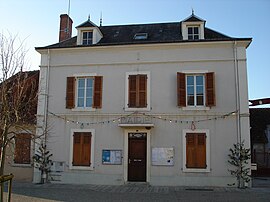 The town hall in Thevet-Saint-Julien | |
show Location of Thevet-Saint-Julien | |
 Thevet-Saint-Julien | |
| Coordinates: 46°38′17″N 2°04′11″E / 46.6381°N 2.0697°ECoordinates: 46°38′17″N 2°04′11″E / 46.6381°N 2.0697°E | |
| Country | France |
| Region | Centre-Val de Loire |
| Department | Indre |
| Arrondissement | La Châtre |
| Canton | La Châtre |
| Government | |
| • Mayor (2008–2014) | René Lory |
| Area 1 | 30.94 km2 (11.95 sq mi) |
| Population (Jan. 2018)[1] | 385 |
| • Density | 12/km2 (32/sq mi) |
| Time zone | UTC+01:00 (CET) |
| • Summer (DST) | UTC+02:00 (CEST) |
| INSEE/Postal code | 36221 /36400 |
| Elevation | 187–263 m (614–863 ft) (avg. 213 m or 699 ft) |
| 1 French Land Register data, which excludes lakes, ponds, glaciers > 1 km2 (0.386 sq mi or 247 acres) and river estuaries. | |


Thevet-Saint-Julien is a commune in the Indre department in central France.[2]
Population[]
|
|
See also[]
- Communes of the Indre department
References[]
- ^ "Populations légales 2018". INSEE. 28 December 2020.
- ^ INSEE commune file
| Wikimedia Commons has media related to Thevet-Saint-Julien. |
| show Communes of the Indre department |
|---|
This Indre geographical article is a stub. You can help Wikipedia by . |
Categories:
- Communes of Indre
- Indre geography stubs