Néret
Néret | |
|---|---|
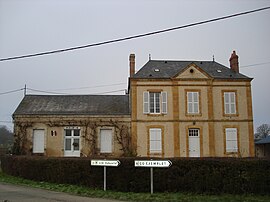 The town hall in Néret | |
show Location of Néret | |
 Néret | |
| Coordinates: 46°34′11″N 2°08′58″E / 46.5697°N 2.1494°ECoordinates: 46°34′11″N 2°08′58″E / 46.5697°N 2.1494°E | |
| Country | France |
| Region | Centre-Val de Loire |
| Department | Indre |
| Arrondissement | La Châtre |
| Canton | La Châtre |
| Intercommunality | La Châtre et Sainte-Sévère |
| Government | |
| • Mayor (2020–2026) | Jean-Michel Medar |
| Area 1 | 19.05 km2 (7.36 sq mi) |
| Population (Jan. 2018)[1] | 189 |
| • Density | 9.9/km2 (26/sq mi) |
| Time zone | UTC+01:00 (CET) |
| • Summer (DST) | UTC+02:00 (CEST) |
| INSEE/Postal code | 36138 /36400 |
| Elevation | 219–282 m (719–925 ft) (avg. 230 m or 750 ft) |
| 1 French Land Register data, which excludes lakes, ponds, glaciers > 1 km2 (0.386 sq mi or 247 acres) and river estuaries. | |


Néret (French pronunciation: [neʁɛ]) is a commune in the Indre department in central France.
Population[]
|
|
See also[]
- Communes of the Indre department
References[]
- ^ "Populations légales 2018". INSEE. 28 December 2020.
| Wikimedia Commons has media related to Néret. |
| show Communes of the Indre department |
|---|
This Indre geographical article is a stub. You can help Wikipedia by . |
Categories:
- Communes of Indre
- Indre geography stubs