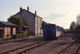
Luçay-le-Mâle
Luçay-le-Mâle | |
|---|---|
 Town hall | |
 Coat of arms | |
show Location of Luçay-le-Mâle | |
 Luçay-le-Mâle | |
| Coordinates: 47°07′51″N 1°26′32″E / 47.1308°N 1.4422°ECoordinates: 47°07′51″N 1°26′32″E / 47.1308°N 1.4422°E | |
| Country | France |
| Region | Centre-Val de Loire |
| Department | Indre |
| Arrondissement | Châteauroux |
| Canton | Valençay |
| Intercommunality | Écueillé-Valençay |
| Government | |
| • Mayor (2020–2026) | Bruno Taillandier |
| Area 1 | 68.08 km2 (26.29 sq mi) |
| Population (Jan. 2018)[1] | 1,355 |
| • Density | 20/km2 (52/sq mi) |
| Time zone | UTC+01:00 (CET) |
| • Summer (DST) | UTC+02:00 (CEST) |
| INSEE/Postal code | 36103 /36360 |
| Elevation | 97–182 m (318–597 ft) (avg. 125 m or 410 ft) |
| 1 French Land Register data, which excludes lakes, ponds, glaciers > 1 km2 (0.386 sq mi or 247 acres) and river estuaries. | |


Luçay-le-Mâle (French pronunciation: [lysɛ lə mal] (![]() listen)) is a commune in the Indre department in central France.
listen)) is a commune in the Indre department in central France.
Population[]
|
|
See also[]
- Communes of the Indre department
References[]
- ^ "Populations légales 2018". INSEE. 28 December 2020.
| Wikimedia Commons has media related to Luçay-le-Mâle. |
| show Communes of the Indre department |
|---|
| show Authority control |
|---|
This Indre geographical article is a stub. You can help Wikipedia by . |
Categories:
- Communes of Indre
- Indre geography stubs