Oulches
Oulches | |
|---|---|
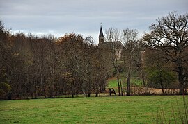 The church in the distance | |
show Location of Oulches | |
 Oulches | |
| Coordinates: 46°36′58″N 1°17′53″E / 46.6161°N 1.2981°ECoordinates: 46°36′58″N 1°17′53″E / 46.6161°N 1.2981°E | |
| Country | France |
| Region | Centre-Val de Loire |
| Department | Indre |
| Arrondissement | Le Blanc |
| Canton | Saint-Gaultier |
| Intercommunality | Brenne Val de Creuse |
| Government | |
| • Mayor (2020–2026) | Claude Mériot[1] |
| Area 1 | 43.36 km2 (16.74 sq mi) |
| Population (Jan. 2018)[2] | 409 |
| • Density | 9.4/km2 (24/sq mi) |
| Time zone | UTC+01:00 (CET) |
| • Summer (DST) | UTC+02:00 (CEST) |
| INSEE/Postal code | 36148 /36800 |
| Elevation | 84–163 m (276–535 ft) (avg. 125 m or 410 ft) |
| 1 French Land Register data, which excludes lakes, ponds, glaciers > 1 km2 (0.386 sq mi or 247 acres) and river estuaries. | |


Oulches (French pronunciation: [ulʃ]) is a commune in the Indre department in central France.
Geography[]
The commune is located in the parc naturel régional de la Brenne.
Population[]
|
|
See also[]
- Communes of the Indre department
References[]
- ^ "Répertoire national des élus: les maires". data.gouv.fr, Plateforme ouverte des données publiques françaises (in French). 2 December 2020.
- ^ "Populations légales 2018". INSEE. 28 December 2020.
| Wikimedia Commons has media related to Oulches. |
| show Communes of the Indre department |
|---|
| show Authority control |
|---|
This Indre geographical article is a stub. You can help Wikipedia by . |
Categories:
- Communes of Indre
- Bituriges Cubi
- Indre geography stubs