Préaux, Indre
Préaux | |
|---|---|
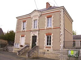 The town hall in Préaux | |
show Location of Préaux | |
 Préaux | |
| Coordinates: 47°01′19″N 1°17′36″E / 47.0219°N 1.2933°ECoordinates: 47°01′19″N 1°17′36″E / 47.0219°N 1.2933°E | |
| Country | France |
| Region | Centre-Val de Loire |
| Department | Indre |
| Arrondissement | Châteauroux |
| Canton | Valençay |
| Intercommunality | Écueillé-Valençay |
| Government | |
| • Mayor (2008–2014) | Christian Simon |
| Area 1 | 32.54 km2 (12.56 sq mi) |
| Population (Jan. 2018)[1] | 163 |
| • Density | 5.0/km2 (13/sq mi) |
| Time zone | UTC+01:00 (CET) |
| • Summer (DST) | UTC+02:00 (CEST) |
| INSEE/Postal code | 36166 /36240 |
| Elevation | 124–194 m (407–636 ft) (avg. 146 m or 479 ft) |
| 1 French Land Register data, which excludes lakes, ponds, glaciers > 1 km2 (0.386 sq mi or 247 acres) and river estuaries. | |


Préaux is a commune in the Indre department in central France.
Geography[]
The village lies on the left bank of the Indrois, which flows northwest through the southern part of the commune and forms part of its western border.
Population[]
|
|
See also[]
- Communes of the Indre department
References[]
- ^ "Populations légales 2018". INSEE. 28 December 2020.
| Wikimedia Commons has media related to Préaux (Indre). |
| show Communes of the Indre department |
|---|
This Indre geographical article is a stub. You can help Wikipedia by . |
Categories:
- Communes of Indre
- Indre geography stubs