Bazugues
Bazugues | |
|---|---|
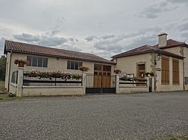 The town hall in Bazugues | |
show Location of Bazugues | |
 Bazugues | |
| Coordinates: 43°26′57″N 0°20′42″E / 43.4492°N 0.345°ECoordinates: 43°26′57″N 0°20′42″E / 43.4492°N 0.345°E | |
| Country | France |
| Region | Occitanie |
| Department | Gers |
| Arrondissement | Mirande |
| Canton | Mirande-Astarac |
| Government | |
| • Mayor (2020–2026) | Jean-Noël Jammet[1] |
| Area 1 | 5.36 km2 (2.07 sq mi) |
| Population (Jan. 2018)[2] | 55 |
| • Density | 10/km2 (27/sq mi) |
| Time zone | UTC+01:00 (CET) |
| • Summer (DST) | UTC+02:00 (CEST) |
| INSEE/Postal code | 32034 /32170 |
| Elevation | 195–301 m (640–988 ft) (avg. 170 m or 560 ft) |
| 1 French Land Register data, which excludes lakes, ponds, glaciers > 1 km2 (0.386 sq mi or 247 acres) and river estuaries. | |


Bazugues (French pronunciation: [bazyɡ]; Occitan: Basugas) is a commune in the Gers department in southwestern France.
Geography[]

Bazugues and its surrounding communes
Population[]
| Year | Pop. | ±% |
|---|---|---|
| 1962 | 69 | — |
| 1968 | 68 | −1.4% |
| 1975 | 57 | −16.2% |
| 1982 | 56 | −1.8% |
| 1990 | 67 | +19.6% |
| 1999 | 55 | −17.9% |
| 2008 | 58 | +5.5% |
See also[]
- Communes of the Gers department
References[]
- ^ "Répertoire national des élus: les maires". data.gouv.fr, Plateforme ouverte des données publiques françaises (in French). 2 December 2020. Retrieved 7 December 2020.
- ^ "Populations légales 2018". INSEE. 28 December 2020.
| Wikimedia Commons has media related to Bazugues. |
| show Communes of the Gers department |
|---|
This Gers geographical article is a stub. You can help Wikipedia by . |
Categories:
- Communes of Gers
- Gers geography stubs