Belleherbe
Belleherbe | |
|---|---|
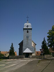 The church in Belleherbe | |
show Location of Belleherbe | |
 Belleherbe | |
| Coordinates: 47°15′46″N 6°39′32″E / 47.2628°N 6.6589°ECoordinates: 47°15′46″N 6°39′32″E / 47.2628°N 6.6589°E | |
| Country | France |
| Region | Bourgogne-Franche-Comté |
| Department | Doubs |
| Arrondissement | Montbéliard |
| Canton | Valdahon |
| Government | |
| • Mayor (2020–2026) | Philippe Franchini[1] |
| Area 1 | 16.13 km2 (6.23 sq mi) |
| Population (Jan. 2018)[2] | 624 |
| • Density | 39/km2 (100/sq mi) |
| Time zone | UTC+01:00 (CET) |
| • Summer (DST) | UTC+02:00 (CEST) |
| INSEE/Postal code | 25051 /25380 |
| Elevation | 590–854 m (1,936–2,802 ft) |
| 1 French Land Register data, which excludes lakes, ponds, glaciers > 1 km2 (0.386 sq mi or 247 acres) and river estuaries. | |


Belleherbe is a commune in the Doubs department in the Bourgogne-Franche-Comté region in eastern France.
Population[]
| Year | Pop. | ±% |
|---|---|---|
| 1962 | 583 | — |
| 1968 | 628 | +7.7% |
| 1975 | 650 | +3.5% |
| 1982 | 617 | −5.1% |
| 1990 | 629 | +1.9% |
| 1999 | 574 | −8.7% |
| 2008 | 587 | +2.3% |
| 2012 | 587 | +0.0% |
See also[]
References[]
- ^ "Répertoire national des élus: les maires". data.gouv.fr, Plateforme ouverte des données publiques françaises (in French). 2 December 2020.
- ^ "Populations légales 2018". INSEE. 28 December 2020.
| Wikimedia Commons has media related to Belleherbe. |
This Doubs geographical article is a stub. You can help Wikipedia by . |
Categories:
- Communes of Doubs
- Doubs geography stubs