Boncourt, Eure-et-Loir
Boncourt | |
|---|---|
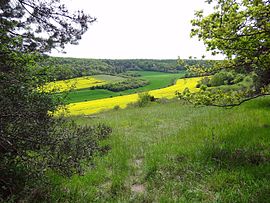 The regional natural reserve of the Cailles Valley | |
show Location of Boncourt | |
 Boncourt | |
| Coordinates: 48°50′51″N 1°27′43″E / 48.8475°N 1.4619°ECoordinates: 48°50′51″N 1°27′43″E / 48.8475°N 1.4619°E | |
| Country | France |
| Region | Centre-Val de Loire |
| Department | Eure-et-Loir |
| Arrondissement | Dreux |
| Canton | Anet |
| Intercommunality | CA Pays de Dreux |
| Government | |
| • Mayor (2020–2026) | Jean-Claude Delanoé[1] |
| Area 1 | 3.71 km2 (1.43 sq mi) |
| Population (Jan. 2018)[2] | 266 |
| • Density | 72/km2 (190/sq mi) |
| Time zone | UTC+01:00 (CET) |
| • Summer (DST) | UTC+02:00 (CEST) |
| INSEE/Postal code | 28050 /28260 |
| Elevation | 62–125 m (203–410 ft) (avg. 70 m or 230 ft) |
| 1 French Land Register data, which excludes lakes, ponds, glaciers > 1 km2 (0.386 sq mi or 247 acres) and river estuaries. | |


Boncourt is a commune in the Eure-et-Loir department in northern France.
Population[]
| Year | Pop. | ±% |
|---|---|---|
| 1962 | 128 | — |
| 1968 | 132 | +3.1% |
| 1975 | 145 | +9.8% |
| 1982 | 124 | −14.5% |
| 1990 | 191 | +54.0% |
| 1999 | 239 | +25.1% |
| 2008 | 275 | +15.1% |
See also[]
- Communes of the Eure-et-Loir department
References[]
- ^ "Répertoire national des élus: les maires". data.gouv.fr, Plateforme ouverte des données publiques françaises (in French). 2 December 2020.
- ^ "Populations légales 2018". INSEE. 28 December 2020.
| Wikimedia Commons has media related to Boncourt (Eure-et-Loir). |
| show Communes of the Eure-et-Loir department of France |
|---|
| show Authority control |
|---|
This Eure-et-Loir geographical article is a stub. You can help Wikipedia by . |
Categories:
- Communes of Eure-et-Loir
- Eure-et-Loir geography stubs