Brey-et-Maison-du-Bois
Brey-et-Maison-du-Bois | |
|---|---|
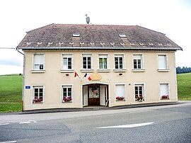 The town hall in Le Brey | |
show Location of Brey-et-Maison-du-Bois | |
 Brey-et-Maison-du-Bois | |
| Coordinates: 46°44′42″N 6°15′08″E / 46.745°N 6.2522°ECoordinates: 46°44′42″N 6°15′08″E / 46.745°N 6.2522°E | |
| Country | France |
| Region | Bourgogne-Franche-Comté |
| Department | Doubs |
| Arrondissement | Pontarlier |
| Canton | Frasne |
| Government | |
| • Mayor (2020–2026) | Didier Minniti[1] |
| Area 1 | 6.18 km2 (2.39 sq mi) |
| Population (Jan. 2018)[2] | 123 |
| • Density | 20/km2 (52/sq mi) |
| Time zone | UTC+01:00 (CET) |
| • Summer (DST) | UTC+02:00 (CEST) |
| INSEE/Postal code | 25096 /25240 |
| Elevation | 868–1,055 m (2,848–3,461 ft) |
| 1 French Land Register data, which excludes lakes, ponds, glaciers > 1 km2 (0.386 sq mi or 247 acres) and river estuaries. | |


Brey-et-Maison-du-Bois (French pronunciation: [bʁɛ e mɛzɔ̃ dy bwa]) is a commune in the Doubs department in the Bourgogne-Franche-Comté region in eastern France.
Population[]
| Year | Pop. | ±% |
|---|---|---|
| 1790 | 208 | — |
| 1851 | 206 | −1.0% |
| 1962 | 97 | −52.9% |
| 1968 | 101 | +4.1% |
| 1975 | 91 | −9.9% |
| 1982 | 74 | −18.7% |
| 1990 | 74 | +0.0% |
| 1999 | 100 | +35.1% |
| 2008 | 104 | +4.0% |
| 2012 | 92 | −11.5% |
See also[]
References[]
- ^ "Répertoire national des élus: les maires". data.gouv.fr, Plateforme ouverte des données publiques françaises (in French). 2 December 2020.
- ^ "Populations légales 2018". INSEE. 28 December 2020.
| Wikimedia Commons has media related to Brey-et-Maison-du-Bois. |
This Doubs geographical article is a stub. You can help Wikipedia by . |
Categories:
- Communes of Doubs
- Doubs geography stubs