Candas
Candas | |
|---|---|
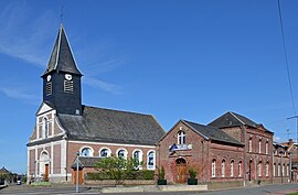 The church and town hall in Candas | |
 Coat of arms | |
show Location of Candas | |
 Candas | |
| Coordinates: 50°06′29″N 2°15′37″E / 50.1081°N 2.2603°ECoordinates: 50°06′29″N 2°15′37″E / 50.1081°N 2.2603°E | |
| Country | France |
| Region | Hauts-de-France |
| Department | Somme |
| Arrondissement | Amiens |
| Canton | Doullens |
| Intercommunality | CC Territoire Nord Picardie |
| Government | |
| • Mayor (2020–2026) | Dominique Hersin[1] |
| Area 1 | 17.27 km2 (6.67 sq mi) |
| Population (Jan. 2018)[2] | 1,104 |
| • Density | 64/km2 (170/sq mi) |
| Time zone | UTC+01:00 (CET) |
| • Summer (DST) | UTC+02:00 (CEST) |
| INSEE/Postal code | 80168 /80750 |
| Elevation | 97–166 m (318–545 ft) (avg. 146 m or 479 ft) |
| 1 French Land Register data, which excludes lakes, ponds, glaciers > 1 km2 (0.386 sq mi or 247 acres) and river estuaries. | |


Candas is a commune in the Somme department in Hauts-de-France in northern France.
Geography[]
Candas is situated on the D31 and D49 crossroads, some 21 miles (34 km) north of Amiens.
Places of interest[]
- Fanchon's windmill [3]
The sails stopped turning in 1923, on the death of the last miller, Louis Fanchon (who acquired the mill in 1882). The building was left to nature, and was soon covered in moss and grass, with bushes growing through every opening. Much of the structure began to crumble. After more than 10 years restoration, thanks to the dynamism of the 'Association de Sauvegarde du Patrimoine de Candas, the mill is now open to the public. There's a guided tour and demonstrations of flour production.
See also[]
References[]
- ^ "Répertoire national des élus: les maires". data.gouv.fr, Plateforme ouverte des données publiques françaises (in French). 2 December 2020.
- ^ "Populations légales 2018". INSEE. 28 December 2020.
- ^ Le moulin de Candas, Pierre Desbureaux, « Le Généalogiste Picard » n° 103 (premier trimestre 2003), page 20 - ISSN 0767-3752
External links[]
| Wikimedia Commons has media related to Candas. |
- Candas website (in French)
- Visit to the mill at Candas, on the "Chez Marius" website (in French)
| show Authority control |
|---|
Categories:
- Communes of Somme (department)
- Amiens arrondissement geography stubs