Charmoille, Doubs
Charmoille | |
|---|---|
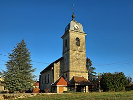 The church in Charmoille | |
 Coat of arms | |
show Location of Charmoille | |
 Charmoille | |
| Coordinates: 47°14′47″N 6°40′18″E / 47.2464°N 6.6717°ECoordinates: 47°14′47″N 6°40′18″E / 47.2464°N 6.6717°E | |
| Country | France |
| Region | Bourgogne-Franche-Comté |
| Department | Doubs |
| Arrondissement | Montbéliard |
| Canton | Valdahon |
| Government | |
| • Mayor (2020–2026) | Vincent Courty |
| Area 1 | 10.14 km2 (3.92 sq mi) |
| Population (Jan. 2018)[1] | 327 |
| • Density | 32/km2 (84/sq mi) |
| Time zone | UTC+01:00 (CET) |
| • Summer (DST) | UTC+02:00 (CEST) |
| INSEE/Postal code | 25125 /25380 |
| Elevation | 460–852 m (1,509–2,795 ft) |
| 1 French Land Register data, which excludes lakes, ponds, glaciers > 1 km2 (0.386 sq mi or 247 acres) and river estuaries. | |


Charmoille (French pronunciation: [ʃaʁmwaj]) is a commune in the Doubs department in the Bourgogne-Franche-Comté region in eastern France.
Population[]
| Year | Pop. | ±% |
|---|---|---|
| 1962 | 331 | — |
| 1968 | 356 | +7.6% |
| 1975 | 326 | −8.4% |
| 1982 | 316 | −3.1% |
| 1990 | 298 | −5.7% |
| 1999 | 297 | −0.3% |
| 2008 | 303 | +2.0% |
| 2012 | 318 | +5.0% |
See also[]
References[]
- ^ "Populations légales 2018". INSEE. 28 December 2020.
| Wikimedia Commons has media related to Charmoille (Doubs). |
| show Authority control |
|---|
This Doubs geographical article is a stub. You can help Wikipedia by . |
Categories:
- Communes of Doubs
- Doubs geography stubs