Charquemont
Charquemont | |
|---|---|
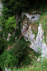 Ladders of death | |
 Coat of arms | |
show Location of Charquemont | |
 Charquemont | |
| Coordinates: 47°12′54″N 6°49′21″E / 47.215°N 6.8225°ECoordinates: 47°12′54″N 6°49′21″E / 47.215°N 6.8225°E | |
| Country | France |
| Region | Bourgogne-Franche-Comté |
| Department | Doubs |
| Arrondissement | Montbéliard |
| Canton | Maîche |
| Government | |
| • Mayor (2020–2026) | Roland Martin |
| Area 1 | 21.44 km2 (8.28 sq mi) |
| Population (Jan. 2018)[1] | 2,680 |
| • Density | 130/km2 (320/sq mi) |
| Time zone | UTC+01:00 (CET) |
| • Summer (DST) | UTC+02:00 (CEST) |
| INSEE/Postal code | 25127 /25140 |
| Elevation | 535–1,043 m (1,755–3,422 ft) |
| 1 French Land Register data, which excludes lakes, ponds, glaciers > 1 km2 (0.386 sq mi or 247 acres) and river estuaries. | |


Charquemont (French pronunciation: [ʃaʁkəmɔ̃]) is a commune in the Doubs department in the Bourgogne-Franche-Comté region in eastern France.
Population[]
| Year | Pop. | ±% |
|---|---|---|
| 1962 | 2,416 | — |
| 1968 | 2,423 | +0.3% |
| 1975 | 2,485 | +2.6% |
| 1982 | 2,265 | −8.9% |
| 1990 | 2,205 | −2.6% |
| 1999 | 2,209 | +0.2% |
| 2008 | 2,438 | +10.4% |
| 2012 | 2,515 | +3.2% |
See also[]
References[]
- ^ "Populations légales 2018". INSEE. 28 December 2020.
External links[]
| Wikimedia Commons has media related to Charquemont. |
- Official website (in French)
This Doubs geographical article is a stub. You can help Wikipedia by . |
Categories:
- Communes of Doubs
- Doubs geography stubs