Franvillers
Franvillers | |
|---|---|
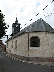 The church in Franvillers | |
 Coat of arms | |
show Location of Franvillers | |
 Franvillers | |
| Coordinates: 49°58′01″N 2°30′29″E / 49.9669°N 2.5081°ECoordinates: 49°58′01″N 2°30′29″E / 49.9669°N 2.5081°E | |
| Country | France |
| Region | Hauts-de-France |
| Department | Somme |
| Arrondissement | Amiens |
| Canton | Corbie |
| Intercommunality | Val de Somme |
| Government | |
| • Mayor (2020–2026) | Delia Sanjuan[1] |
| Area 1 | 4.77 km2 (1.84 sq mi) |
| Population (Jan. 2018)[2] | 507 |
| • Density | 110/km2 (280/sq mi) |
| Time zone | UTC+01:00 (CET) |
| • Summer (DST) | UTC+02:00 (CEST) |
| INSEE/Postal code | 80350 /80800 |
| Elevation | 87–121 m (285–397 ft) (avg. 106 m or 348 ft) |
| 1 French Land Register data, which excludes lakes, ponds, glaciers > 1 km2 (0.386 sq mi or 247 acres) and river estuaries. | |


Franvillers is a commune in the Somme department in Hauts-de-France in northern France.
Geography[]
Franvillers is situated 10 miles (16 km) northeast of Amiens at the junction of the D929 and D23 roads
Population[]
| Year | 1962 | 1968 | 1975 | 1982 | 1990 | 1999 | 2006 |
|---|---|---|---|---|---|---|---|
| Population | 404 | 426 | 427 | 481 | 519 | 493 | 502 |
| From the year 1962 on: No double counting—residents of multiple communes (e.g. students and military personnel) are counted only once. | |||||||
Places of interest[]
- The war memorial
See also[]
References[]
- ^ "Répertoire national des élus: les maires". data.gouv.fr, Plateforme ouverte des données publiques françaises (in French). 2 December 2020.
- ^ "Populations légales 2018". INSEE. 28 December 2020.
External links[]
| Wikimedia Commons has media related to Franvillers. |
- Photos (in French)
Categories:
- Communes of Somme (department)
- Amiens arrondissement geography stubs