Hangest-en-Santerre
Hangest-en-Santerre | |
|---|---|
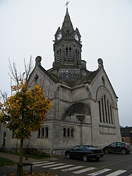 The church in Hangest-en-Santerre | |
 Coat of arms | |
Location of Hangest-en-Santerre  | |
 Hangest-en-Santerre  Hangest-en-Santerre | |
| Coordinates: 49°45′15″N 2°36′24″E / 49.7542°N 2.6067°ECoordinates: 49°45′15″N 2°36′24″E / 49.7542°N 2.6067°E | |
| Country | France |
| Region | Hauts-de-France |
| Department | Somme |
| Arrondissement | Montdidier |
| Canton | Moreuil |
| Intercommunality | CC Avre Luce Noye |
| Government | |
| • Mayor (2020–2026) | Patrick Jubert[1] |
| Area 1 | 15.08 km2 (5.82 sq mi) |
| Population (Jan. 2018)[2] | 1,014 |
| • Density | 67/km2 (170/sq mi) |
| Time zone | UTC+01:00 (CET) |
| • Summer (DST) | UTC+02:00 (CEST) |
| INSEE/Postal code | 80415 /80134 |
| Elevation | 84–109 m (276–358 ft) (avg. 105 m or 344 ft) |
| 1 French Land Register data, which excludes lakes, ponds, glaciers > 1 km2 (0.386 sq mi or 247 acres) and river estuaries. | |
Hangest-en-Santerre (French pronunciation: [ɑ̃ʒɛst ɑ̃ sɑ̃tɛʁ], literally Hangest in Santerre) is a commune in the Somme department in Hauts-de-France in northern France.
Geography[]
The commune is situated at the D41 and D54 crossroads, 16 kilometres (10 mi) southeast of Amiens.
Population[]
| Year | 1962 | 1968 | 1975 | 1982 | 1990 | 1999 | 2006 |
|---|---|---|---|---|---|---|---|
| Population | 753 | 801 | 769 | 703 | 723 | 839 | 997 |
| From the year 1962 on: No double counting—residents of multiple communes (e.g. students and military personnel) are counted only once. | |||||||
See also[]
References[]
- ^ "Répertoire national des élus: les maires". data.gouv.fr, Plateforme ouverte des données publiques françaises (in French). 2 December 2020.
- ^ "Populations légales 2018". INSEE. 28 December 2020.
| Wikimedia Commons has media related to Hangest-en-Santerre. |
Authority control | |
|---|---|
| General |
|
| National libraries | |
Categories:
- Communes of Somme (department)
- Montdidier arrondissement geography stubs