La Neuville-Sire-Bernard
La Neuville-Sire-Bernard | |
|---|---|
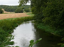 The Avre river at La Neuville-Sire-Bernard | |
show Location of La Neuville-Sire-Bernard | |
 La Neuville-Sire-Bernard | |
| Coordinates: 49°44′33″N 2°30′57″E / 49.7425°N 2.5158°ECoordinates: 49°44′33″N 2°30′57″E / 49.7425°N 2.5158°E | |
| Country | France |
| Region | Hauts-de-France |
| Department | Somme |
| Arrondissement | Montdidier |
| Canton | Moreuil |
| Intercommunality | CC Avre Luce Noye |
| Government | |
| • Mayor (2020–2026) | Philippe Darcis[1] |
| Area 1 | 4.18 km2 (1.61 sq mi) |
| Population (Jan. 2018)[2] | 295 |
| • Density | 71/km2 (180/sq mi) |
| Time zone | UTC+01:00 (CET) |
| • Summer (DST) | UTC+02:00 (CEST) |
| INSEE/Postal code | 80595 /80110 |
| Elevation | 37–104 m (121–341 ft) (avg. 54 m or 177 ft) |
| 1 French Land Register data, which excludes lakes, ponds, glaciers > 1 km2 (0.386 sq mi or 247 acres) and river estuaries. | |


La Neuville-Sire-Bernard is a commune in the Somme department in Hauts-de-France in northern France.
Geography[]
The commune is situated on the D935 road, some 15 miles (24 km) southeast of Amiens, by the banks of the Avre River.
Population[]
| Year | 1962 | 1968 | 1975 | 1982 | 1990 | 1999 | 2006 |
|---|---|---|---|---|---|---|---|
| Population | 105 | 123 | 119 | 157 | 219 | 267 | 273 |
| From the year 1962 on: No double counting—residents of multiple communes (e.g. students and military personnel) are counted only once. | |||||||
See also[]
References[]
- ^ "Répertoire national des élus: les maires". data.gouv.fr, Plateforme ouverte des données publiques françaises (in French). 2 December 2020.
- ^ "Populations légales 2018". INSEE. 28 December 2020.
| Wikimedia Commons has media related to La Neuville-Sire-Bernard. |
Categories:
- Communes of Somme (department)
- Montdidier arrondissement geography stubs