Lafresguimont-Saint-Martin
Lafresguimont-Saint-Martin | |
|---|---|
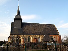 The church in Lafresnoye | |
show Location of Lafresguimont-Saint-Martin | |
 Lafresguimont-Saint-Martin | |
| Coordinates: 49°48′58″N 1°48′35″E / 49.8161°N 1.8097°ECoordinates: 49°48′58″N 1°48′35″E / 49.8161°N 1.8097°E | |
| Country | France |
| Region | Hauts-de-France |
| Department | Somme |
| Arrondissement | Amiens |
| Canton | Poix-de-Picardie |
| Intercommunality | CC Somme Sud-Ouest |
| Government | |
| • Mayor (2020–2026) | Jannick Lefeuvre[1] |
| Area 1 | 26.54 km2 (10.25 sq mi) |
| Population (Jan. 2018)[2] | 549 |
| • Density | 21/km2 (54/sq mi) |
| Time zone | UTC+01:00 (CET) |
| • Summer (DST) | UTC+02:00 (CEST) |
| INSEE/Postal code | 80456 /80430 |
| Elevation | 100–210 m (330–690 ft) (avg. 185 m or 607 ft) |
| 1 French Land Register data, which excludes lakes, ponds, glaciers > 1 km2 (0.386 sq mi or 247 acres) and river estuaries. | |


Lafresguimont-Saint-Martin is a commune in the Somme department in Hauts-de-France in northern France.
Geography[]
The commune is situated at the junction of the D92 and the D178 roads, 40 kilometres (25 mi) southwest of Amiens.
History[]
The commune was created by the amalgamation of four separate communes in 1972 : Montmarquet, Lafresnoye, Guibermesnil and Laboissière-Saint-Martin. The present name is a combination of the older names.
Population[]
| Year | 1962 | 1968 | 1975 | 1982 | 1990 | 1999 | 2006 |
|---|---|---|---|---|---|---|---|
| Population | 575 | 604 | 570 | 501 | 470 | 445 | 516 |
| From the year 1962 on: No double counting—residents of multiple communes (e.g. students and military personnel) are counted only once. | |||||||
See also[]
References[]
- ^ "Répertoire national des élus: les maires". data.gouv.fr, Plateforme ouverte des données publiques françaises (in French). 2 December 2020.
- ^ "Populations légales 2018". INSEE. 28 December 2020.
| Wikimedia Commons has media related to Lafresguimont-Saint-Martin. |
Categories:
- Communes of Somme (department)
- Amiens arrondissement geography stubs