Lanthenans
Lanthenans | |
|---|---|
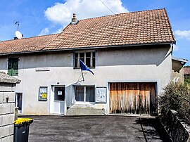 The town hall in Lanthenans | |
 Coat of arms | |
show Location of Lanthenans | |
 Lanthenans | |
| Coordinates: 47°23′44″N 6°37′41″E / 47.3956°N 6.6281°ECoordinates: 47°23′44″N 6°37′41″E / 47.3956°N 6.6281°E | |
| Country | France |
| Region | Bourgogne-Franche-Comté |
| Department | Doubs |
| Arrondissement | Montbéliard |
| Canton | Bavans |
| Government | |
| • Mayor (2008–2014) | Albert Felez |
| Area 1 | 3.36 km2 (1.30 sq mi) |
| Population (Jan. 2018)[1] | 69 |
| • Density | 21/km2 (53/sq mi) |
| Time zone | UTC+01:00 (CET) |
| • Summer (DST) | UTC+02:00 (CEST) |
| INSEE/Postal code | 25327 /25250 |
| Elevation | 389–592 m (1,276–1,942 ft) |
| 1 French Land Register data, which excludes lakes, ponds, glaciers > 1 km2 (0.386 sq mi or 247 acres) and river estuaries. | |


Lanthenans is a commune in the Doubs department in the Bourgogne-Franche-Comté region in eastern France.
Geography[]
The commune lies on a sunny slope with an exceptional microclimate and equidistant from L'Isle-sur-le-Doubs, Pont-de-Roide, and Clerval.
Population[]
| Year | Pop. | ±% |
|---|---|---|
| 1962 | 47 | — |
| 1968 | 58 | +23.4% |
| 1975 | 79 | +36.2% |
| 1982 | 66 | −16.5% |
| 1990 | 60 | −9.1% |
| 1999 | 65 | +8.3% |
| 2008 | 63 | −3.1% |
| 2012 | 66 | +4.8% |
See also[]
References[]
- ^ "Populations légales 2018". INSEE. 28 December 2020.
External links[]
| Wikimedia Commons has media related to Lanthenans. |
This Doubs geographical article is a stub. You can help Wikipedia by . |
Categories:
- Communes of Doubs
- Doubs geography stubs