Lavardens
Lavardens | |
|---|---|
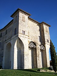 The chateau | |
 Coat of arms | |
show Location of Lavardens | |
 Lavardens | |
| Coordinates: 43°45′42″N 0°30′52″E / 43.7617°N 0.5144°ECoordinates: 43°45′42″N 0°30′52″E / 43.7617°N 0.5144°E | |
| Country | France |
| Region | Occitanie |
| Department | Gers |
| Arrondissement | Auch |
| Canton | Gascogne-Auscitaine |
| Government | |
| • Mayor (2008–2014) | Jean-Pierre Mothe |
| Area 1 | 30.55 km2 (11.80 sq mi) |
| Population (Jan. 2018)[1] | 377 |
| • Density | 12/km2 (32/sq mi) |
| Time zone | UTC+01:00 (CET) |
| • Summer (DST) | UTC+02:00 (CEST) |
| INSEE/Postal code | 32204 /32360 |
| Elevation | 126–245 m (413–804 ft) (avg. 280 m or 920 ft) |
| 1 French Land Register data, which excludes lakes, ponds, glaciers > 1 km2 (0.386 sq mi or 247 acres) and river estuaries. | |


Lavardens (Occitan: Lavardens) is a commune in the Gers department in southwestern France.
Geography[]

Lavardens and its surrounding communes
Population[]
| Year | Pop. | ±% |
|---|---|---|
| 1962 | 517 | — |
| 1968 | 504 | −2.5% |
| 1975 | 422 | −16.3% |
| 1982 | 373 | −11.6% |
| 1990 | 377 | +1.1% |
| 1999 | 378 | +0.3% |
| 2008 | 397 | +5.0% |
See also[]
- Communes of the Gers department
References[]
- ^ "Populations légales 2018". INSEE. 28 December 2020.
| Wikimedia Commons has media related to Lavardens. |
| show Communes of the Gers department |
|---|
| show Authority control |
|---|
This Gers geographical article is a stub. You can help Wikipedia by . |
Categories:
- Communes of Gers
- Gers geography stubs