Les Grangettes
Les Grangettes | |
|---|---|
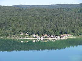 Port Titi | |
show Location of Les Grangettes | |
 Les Grangettes | |
| Coordinates: 46°49′43″N 6°18′43″E / 46.8286°N 6.3119°ECoordinates: 46°49′43″N 6°18′43″E / 46.8286°N 6.3119°E | |
| Country | France |
| Region | Bourgogne-Franche-Comté |
| Department | Doubs |
| Arrondissement | Pontarlier |
| Canton | Frasne |
| Government | |
| • Mayor (2020–2026) | Didier Hernandez[1] |
| Area 1 | 5.38 km2 (2.08 sq mi) |
| Population (Jan. 2018)[2] | 288 |
| • Density | 54/km2 (140/sq mi) |
| Time zone | UTC+01:00 (CET) |
| • Summer (DST) | UTC+02:00 (CEST) |
| INSEE/Postal code | 25295 /25160 |
| Elevation | 847–998 m (2,779–3,274 ft) |
| 1 French Land Register data, which excludes lakes, ponds, glaciers > 1 km2 (0.386 sq mi or 247 acres) and river estuaries. | |


Les Grangettes (French pronunciation: [le ɡʁɑ̃ʒɛt]) is a commune in the Doubs department in the Bourgogne-Franche-Comté region in eastern France.
Population[]
| Year | Pop. | ±% |
|---|---|---|
| 1962 | 60 | — |
| 1968 | 93 | +55.0% |
| 1975 | 104 | +11.8% |
| 1982 | 144 | +38.5% |
| 1990 | 169 | +17.4% |
| 1999 | 182 | +7.7% |
| 2008 | 224 | +23.1% |
| 2012 | 268 | +19.6% |
See also[]
References[]
- ^ "Répertoire national des élus: les maires". data.gouv.fr, Plateforme ouverte des données publiques françaises (in French). 2 December 2020.
- ^ "Populations légales 2018". INSEE. 28 December 2020.
| Wikimedia Commons has media related to Les Grangettes. |
| show Authority control |
|---|
This Doubs geographical article is a stub. You can help Wikipedia by . |
Categories:
- Communes of Doubs
- Ramsar sites in Metropolitan France
- Doubs geography stubs