Malbuisson
Malbuisson | |
|---|---|
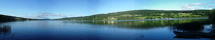
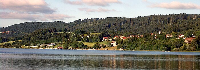
 Malbuisson on the bank of Lake Saint-Point | |
 Coat of arms | |
show Location of Malbuisson | |
 Malbuisson | |
| Coordinates: 46°47′56″N 6°18′15″E / 46.7989°N 6.3042°ECoordinates: 46°47′56″N 6°18′15″E / 46.7989°N 6.3042°E | |
| Country | France |
| Region | Bourgogne-Franche-Comté |
| Department | Doubs |
| Arrondissement | Pontarlier |
| Canton | Frasne |
| Government | |
| • Mayor (2020–2026) | Claude Lietta[1] |
| Area 1 | 6.6 km2 (2.5 sq mi) |
| Population (Jan. 2018)[2] | 849 |
| • Density | 130/km2 (330/sq mi) |
| Time zone | UTC+01:00 (CET) |
| • Summer (DST) | UTC+02:00 (CEST) |
| INSEE/Postal code | 25361 /25160 |
| Elevation | 846–1,091 m (2,776–3,579 ft) |
| 1 French Land Register data, which excludes lakes, ponds, glaciers > 1 km2 (0.386 sq mi or 247 acres) and river estuaries. | |


Malbuisson (French pronunciation: [malbɥisɔ̃]) is a commune in the Doubs department in the Bourgogne-Franche-Comté region in eastern France.[3]
Overview[]
On a terrace above Lake Saint-Point, between water and forest, the village of Malbuisson stretches for two kilometers between Vézenay, a formerly separate village, and the forest of "La Fuvelle". At the beginning of the 20th century, Malbuisson saw a significant expansion with the development of tourism, made possible by the construction of a railway line named the "Tacot" between Pontarlier and Foncine. Then classified "station climatérique" (alt. 900 m), Malbuisson became a pleasant destination for the rich people of Pontarlier and Besançon, but also for Parisians. Since then, the economy of the village has developed mainly around tourism and continues by offering:
- Nordic skiing, Mountain bike trails, hiking or snow shoe excursions in the surrounding mountains
- boating, pedal boats, fishing and swimming in the lake
- hotel establishments and restaurants, and shops offering local products
- nature reserves
Geography[]
Malbuisson lies 15 km (9.3 mi) south of Pontarlier on the Lac de Saint-Point.
Population[]
|
|
Tourism[]
Malbuisson is a village typical of the “Franche-Comté” region, located on the edge of the Saint-Point lake, at an altitude of 850m to 1000m, close to the landmark of the area: Le Mont D’or at 1463m.
Economy[]
In addition to tourism, Malbuisson has one of the last cheese factories to produce Comté cheese in the traditional fashion in big copper cauldrons.
See also[]
References[]
- ^ "Répertoire national des élus: les maires". data.gouv.fr, Plateforme ouverte des données publiques françaises (in French). 2 December 2020.
- ^ "Populations légales 2018". INSEE. 28 December 2020.
- ^ Commune de Malbuisson (25361), INSEE
External links[]
| Wikimedia Commons has media related to Malbuisson. |
- Malbuisson on the intercommunal Web site of the department (in French)
- www.malbuisson.fr - Official website of Malbuisson

| show Authority control |
|---|
- Communes of Doubs