Mancenans-Lizerne
Mancenans-Lizerne | |
|---|---|
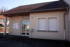 The town hall in Mancenans-Lizerne | |
show Location of Mancenans-Lizerne | |
 Mancenans-Lizerne | |
| Coordinates: 47°15′43″N 6°46′43″E / 47.2619°N 6.7786°ECoordinates: 47°15′43″N 6°46′43″E / 47.2619°N 6.7786°E | |
| Country | France |
| Region | Bourgogne-Franche-Comté |
| Department | Doubs |
| Arrondissement | Montbéliard |
| Canton | Maîche |
| Government | |
| • Mayor (2008–2014) | Serge Orny |
| Area 1 | 6.09 km2 (2.35 sq mi) |
| Population (Jan. 2018)[1] | 193 |
| • Density | 32/km2 (82/sq mi) |
| Time zone | UTC+01:00 (CET) |
| • Summer (DST) | UTC+02:00 (CEST) |
| INSEE/Postal code | 25366 /25120 |
| Elevation | 470–930 m (1,540–3,050 ft) |
| 1 French Land Register data, which excludes lakes, ponds, glaciers > 1 km2 (0.386 sq mi or 247 acres) and river estuaries. | |


Mancenans-Lizerne is a commune in the Doubs department in the Bourgogne-Franche-Comté region in eastern France.
Geography[]
The commune lies 3 km (1.9 mi) from Maîche.
Population[]
| Year | Pop. | ±% |
|---|---|---|
| 1962 | 83 | — |
| 1968 | 98 | +18.1% |
| 1975 | 96 | −2.0% |
| 1982 | 131 | +36.5% |
| 1990 | 131 | +0.0% |
| 1999 | 152 | +16.0% |
| 2008 | 165 | +8.6% |
| 2012 | 186 | +12.7% |
See also[]
References[]
- ^ "Populations légales 2018". INSEE. 28 December 2020.
External links[]
| Wikimedia Commons has media related to Mancenans-Lizerne. |
This Doubs geographical article is a stub. You can help Wikipedia by . |
Categories:
- Communes of Doubs
- Doubs geography stubs