Moncey, Doubs
Moncey | |
|---|---|
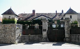 Chateau | |
 Coat of arms | |
Location of Moncey  | |
 Moncey  Moncey | |
| Coordinates: 47°21′47″N 6°07′14″E / 47.3631°N 6.1206°ECoordinates: 47°21′47″N 6°07′14″E / 47.3631°N 6.1206°E | |
| Country | France |
| Region | Bourgogne-Franche-Comté |
| Department | Doubs |
| Arrondissement | Besançon |
| Canton | Baume-les-Dames |
| Government | |
| • Mayor (2008–2014) | Michel Prudhon |
| Area 1 | 5.0 km2 (1.9 sq mi) |
| Population (Jan. 2018)[1] | 594 |
| • Density | 120/km2 (310/sq mi) |
| Time zone | UTC+01:00 (CET) |
| • Summer (DST) | UTC+02:00 (CEST) |
| INSEE/Postal code | 25382 /25870 |
| Elevation | 219–446 m (719–1,463 ft) |
| 1 French Land Register data, which excludes lakes, ponds, glaciers > 1 km2 (0.386 sq mi or 247 acres) and river estuaries. | |
Moncey is a commune in the Doubs department in the Bourgogne-Franche-Comté region in eastern France.
Geography[]
Moncey lies 8 km (5.0 mi) north of Marchaux in the valley of the Ognon. It is surrounded by woods.
Population[]
| Year | Pop. | ±% |
|---|---|---|
| 1962 | 204 | — |
| 1968 | 233 | +14.2% |
| 1975 | 217 | −6.9% |
| 1982 | 349 | +60.8% |
| 1990 | 363 | +4.0% |
| 1999 | 379 | +4.4% |
| 2008 | 478 | +26.1% |
| 2012 | 506 | +5.9% |
See also[]
References[]
- ^ "Populations légales 2018". INSEE. 28 December 2020.
External links[]
| Wikimedia Commons has media related to Moncey. |
|
This Doubs geographical article is a stub. You can help Wikipedia by . |
Categories:
- Communes of Doubs
- Doubs geography stubs