Monfort
Monfort | |
|---|---|
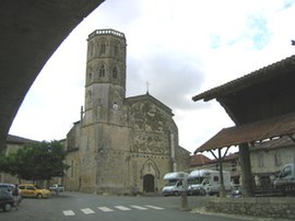 The church in Monfort | |
 Coat of arms | |
show Location of Monfort | |
 Monfort | |
| Coordinates: 43°47′43″N 0°49′29″E / 43.7953°N 0.8247°ECoordinates: 43°47′43″N 0°49′29″E / 43.7953°N 0.8247°E | |
| Country | France |
| Region | Occitanie |
| Department | Gers |
| Arrondissement | Condom |
| Canton | Gimone-Arrats |
| Government | |
| • Mayor (2020–2026) | Régis Lagardere |
| Area 1 | 22.49 km2 (8.68 sq mi) |
| Population (Jan. 2018)[1] | 494 |
| • Density | 22/km2 (57/sq mi) |
| Time zone | UTC+01:00 (CET) |
| • Summer (DST) | UTC+02:00 (CEST) |
| INSEE/Postal code | 32269 /32120 |
| Elevation | 105–194 m (344–636 ft) (avg. 164 m or 538 ft) |
| 1 French Land Register data, which excludes lakes, ponds, glaciers > 1 km2 (0.386 sq mi or 247 acres) and river estuaries. | |


Monfort (French pronunciation: [mɔ̃fɔʁ] (![]() listen); Occitan: Montfòrt) is a commune in the Gers department, in Occitanie region in southwestern France.
listen); Occitan: Montfòrt) is a commune in the Gers department, in Occitanie region in southwestern France.
Geography[]

Monfort and its surrounding communes
Population[]
| Year | Pop. | ±% |
|---|---|---|
| 1962 | 434 | — |
| 1968 | 539 | +24.2% |
| 1975 | 495 | −8.2% |
| 1982 | 454 | −8.3% |
| 1990 | 416 | −8.4% |
| 1999 | 424 | +1.9% |
| 2008 | 479 | +13.0% |
See also[]
- Communes of the Gers department
References[]
- ^ "Populations légales 2018". INSEE. 28 December 2020.
External links[]
| Wikimedia Commons has media related to Monfort (Gers). |
| show Communes of the Gers department |
|---|
This Gers geographical article is a stub. You can help Wikipedia by . |
Categories:
- Communes of Gers
- Gers geography stubs